
The Russian Geographical Society has a long history and huge plans. Photo: Vadim Shtrik
Every day in the life of the Russian Geographical Society there are events that appear on our website in the form of news, articles, interviews and reports. If you put them together, you get a whole book — bright, informative, with a twisting plot, and an open ending. On the eve of December 31, we, as they say, scrolled through this year and selected 10 events that will definitely go down in the history of geography and the RGS. Let’s remember together what the past year was like.
The Congress of the RGS and the announcement of the Year of Geography
The XVII Congress of the Russian Geographical Society, held in October, confirmed that Russia’s oldest public organization does not just continue the noble mission of its founding fathers, prominent scientists, travelers, and statesmen. The RGS is involved in the most relevant issues of the country, ranging from nature conservation and its study, ending with issues of education and even geopolitics. Sergei Shoigu, President of the RGS, speaking at the congress, noted that all the instructions given by the President of Russia and Chairman of the Board of Trustees of the RGS Vladimir Putin in 2014 had been fulfilled, and on top of that, many new ideas had been implemented. The head of state emphasized the role of geography and the Russian Geographical Society itself in a special way, proposing to declare 2027 the Year of Geography in Russia.
The RGS is a close-knit team. Photo: Ksenia Mikhailova
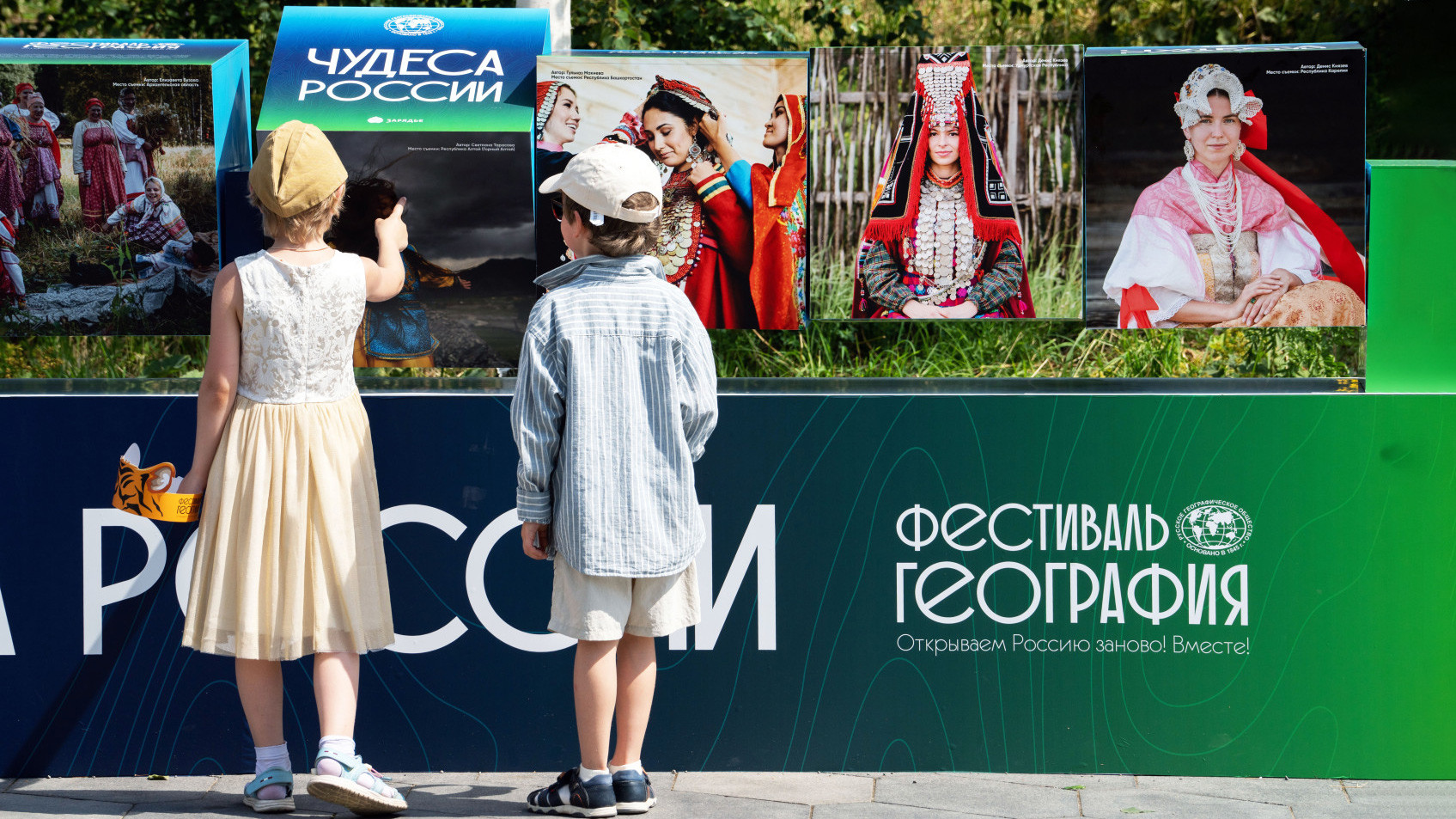
The «Wonders of Russia» festival and the 180th anniversary of the RGS
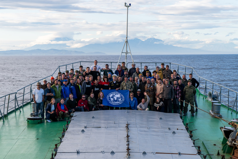
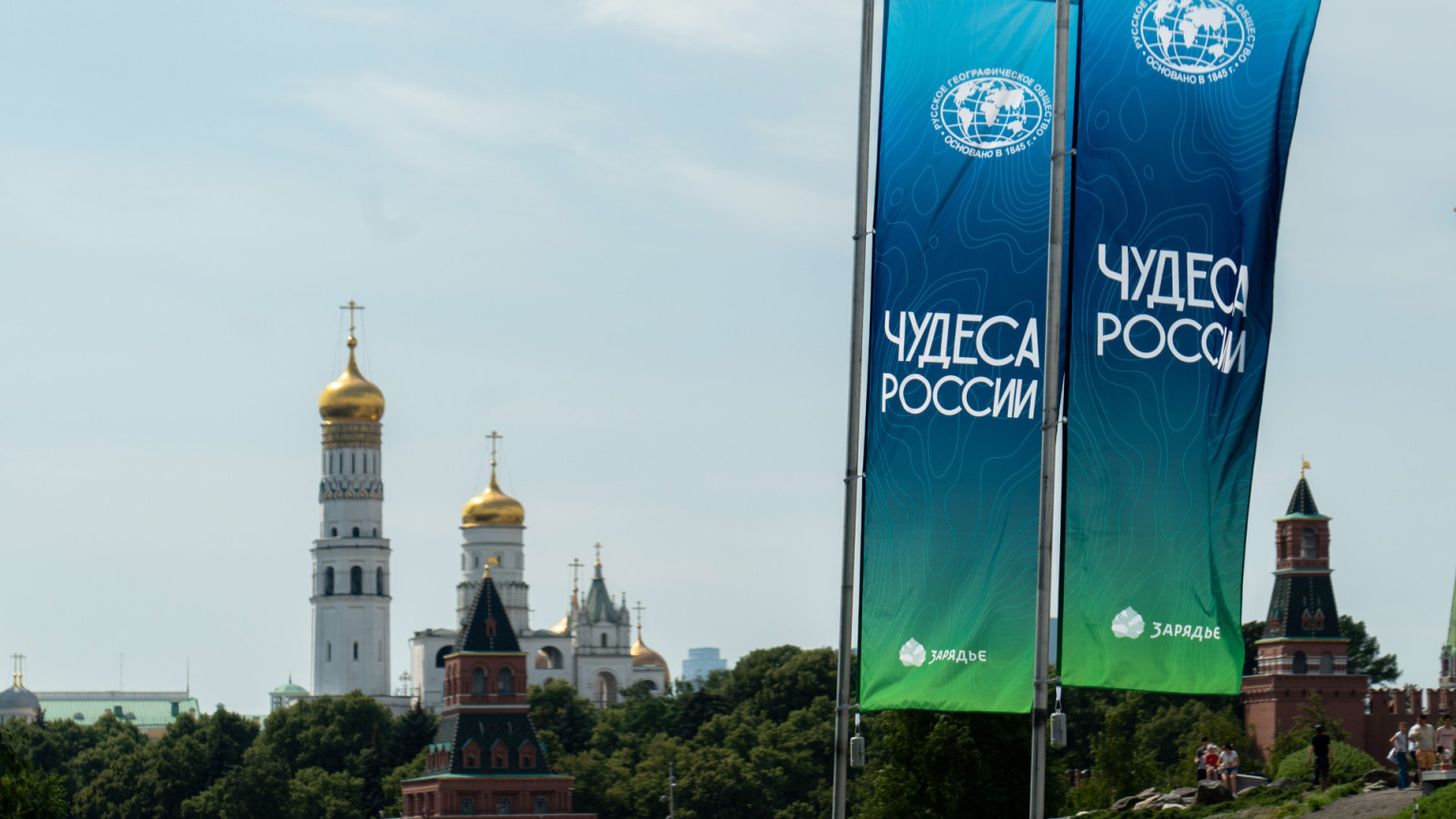
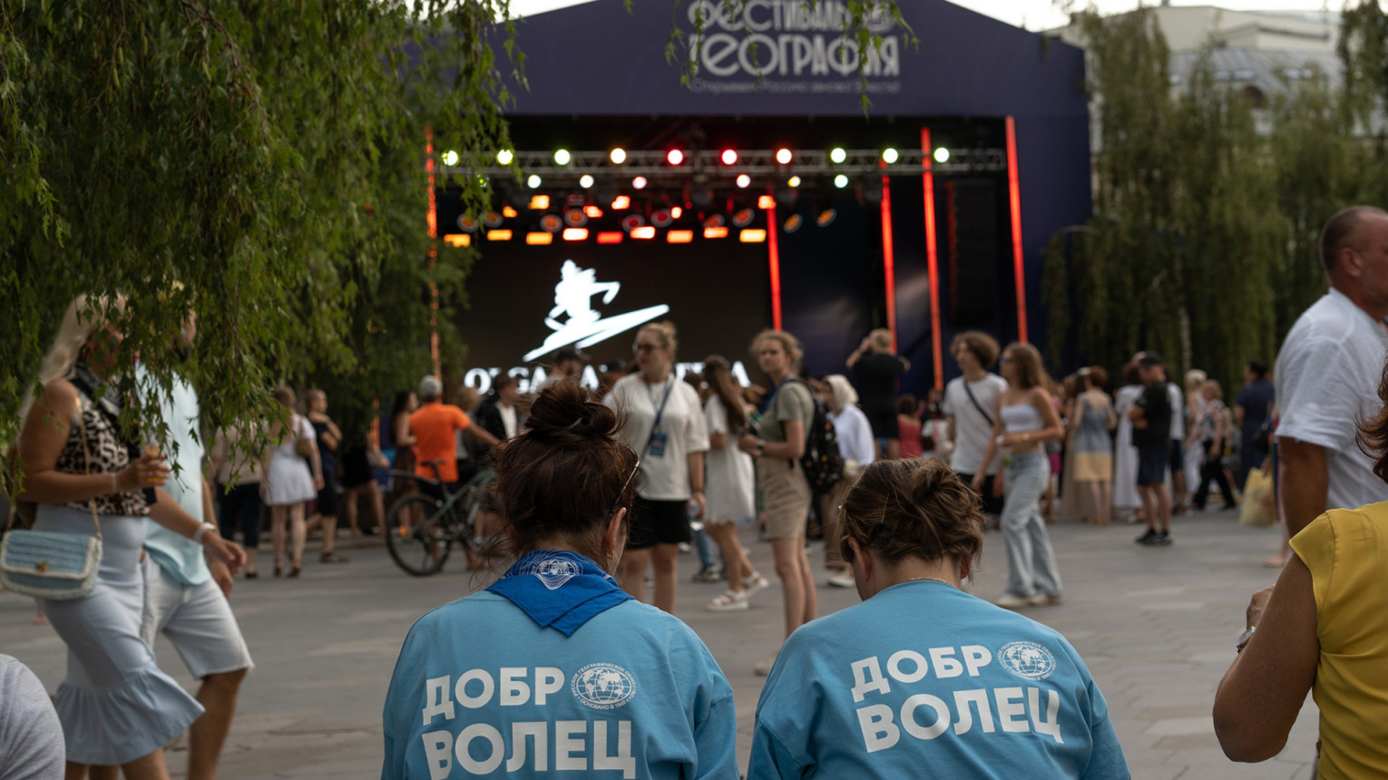
If the RGS Congress is an expert platform for discussing ideas and long-term plans, then the VI Festival of the RGS «Wonders of Russia», which took place at Zaryadye Park in the capital from July 12 to 20, 2025, became a showcase of our activities for the widest possible audience. The multi-day and vibrant geographical celebration in Zaryadye Park was attended by about 600,000 Russians and foreign guests. Concerts, lectures, workshops, film screenings, competitions, excursions — the festival has become a new cultural tradition in Moscow and a meeting place for people and ideas. Since the launch of the RGS festival project in 2014, approximately 2 million people who are passionate about geography and travel in Russia have become participants. This geography festival was dedicated to the 180th anniversary of the RGS, which we celebrated a month later.


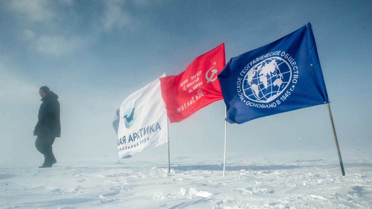
Expedition to the flag on Wrangel Island
The joint expeditions of the RGS and the Russian Ministry of Defense have their own long history, research programs and a special logic. In September 2025, the expedition members to Wrangel Island, separated from the coast of Chukotka by the 140-kilometer Long Strait, completed another symbolic mission.
As Artyom Manukyan, Vice-President of the RGS, recalled, more than 100 years ago, in 1924, the crew of the gunboat «Krasny Oktyabr» raised the Soviet flag on the island, confirming our sovereignty over this harsh but beautiful land. Two years later, the government officially assigned these territories to the USSR. In full accordance with the famous phrase attributed to Nikolai I: «Where the Russian flag is raised, it should not come down!»
In 1974, on the day of the 50th anniversary of this event, the participants of the polar expedition buried a capsule on the island with a message to the future generations. In 2025, our contemporaries paid tribute to the memory of the «Krasny Oktyabr» crew, updated the memorial plaque, and also buried a new time capsule with a letter addressed to those who will be here in 50 years.
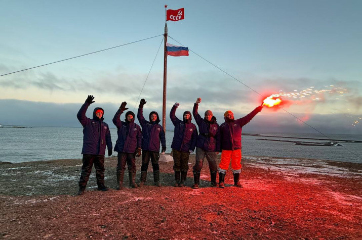
The historic flag on Wrangel Island is more than a hundred years old. Photo provided by the expedition members
The Presidential Nature Fund has been established
On February 7, 2025, Vladimir Putin signed a decree «On the establishment of the Presidential Fund for Ecological and Environmental Protection Projects.»
The Presidential Nature Fund will provide grants from the President of the Russian Federation on a competitive basis for the implementation of environmental and conservation initiatives. The fund also plans to develop and implement its own programs and projects in the field of environmental protection and animal welfare, including in partnership with businesses and non-profit organizations.
The emergence of a new source of targeted support for environmental and conservation initiatives, and even under the auspices of the Presidential Grants Foundation, is good news for researchers and volunteers with interesting ideas and noble hearts.
Environmental protection is one of the main activities of the RGS. Photo: Anna Lukyanchikova, participant of the RGS's contest "The Most Beautiful Country"
Why is this important for the RGS? One of the main lines of activity of the Russian Geographical Society is the protection of the environment and the protection of rare species of animals. Suffice it to say that the very idea of creating nature reserves in Russia came from the heart of the RGS. The vast expertise of the RGS will undoubtedly help in the evaluation and implementation of projects aimed at preserving the country’s ecosystems for future generations.
Mega-earthquake in Kamchatka awakened volcanoes
On July 30, one of the strongest earthquakes ever recorded on our planet occurred off the coast of Kamchatka. Its magnitude was 8.7. The epicenter was located at a depth of 17–18 km about 150 km south-east of Petropavlovsk-Kamchatsky. Then a series of aftershocks occurred. The tremors caused a tsunami.
Strong earthquakes in this region are practically the norm, but experts called the subsequent series of eruptions of neighboring volcanoes a historic event. On August 9, the Klyuchevskoy volcano spewed ash to a height of 11.5 km. But the absolute surprise for everyone was the awakening of the Krasheninnikov volcano, which had been dormant for almost 600 years.
Another curious consequence of summer seismic activity in Kamchatka was the displacement of the peninsula’s borders by 2 m to the southeast.
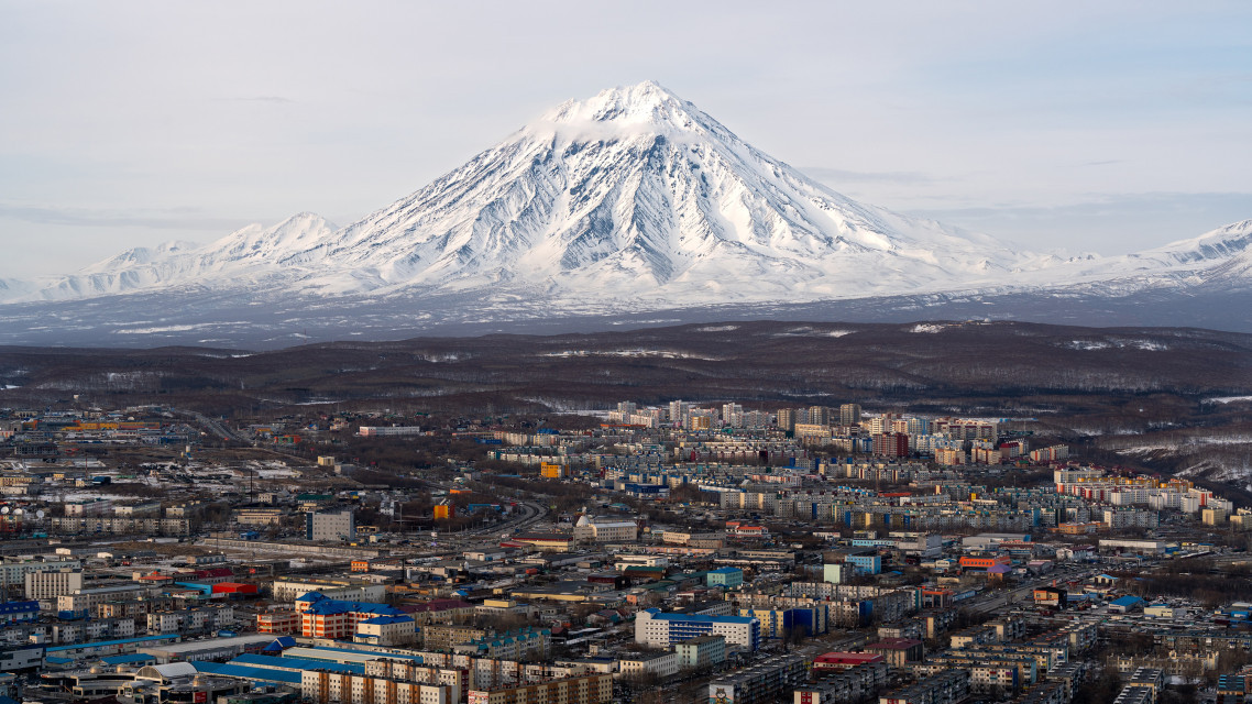
The residents of Petropavlovsk-Kamchatsky have picturesque but restless neighbors. Photo: Anatoly Pavlishchev, participant of the RGS’s contest "The Most Beautiful Country"
Mount Fomin appeared on Novaya Zemlya
In November, Russian Prime Minister Mikhail Mishustin signed an order assigning the name «Mount Fomin» to a previously unnamed mountain in the Novaya Zemlya archipelago. It is located in the northern part of the archipelago’s island Yuzhny, near the entrance to the Matochkin Shar Strait. Exact coordinates: 73°7.3' north, 54°33.9' east.
The new geographical feature will perpetuate the memory of Vice-Admiral Pyotr Fomin (1903–1976). He was at the origin of the creation of the test site on Novaya Zemlya. In 1961, the «Tsar Bomba» with a capacity of 58.6 megatons of TNT was tested here — it is still the most powerful weapon ever activated on Earth.
Unnamed geographical features are rarely given names in Russia. This is due, among other things, to the complexity of the procedure itself. The process was initiated by Colonel Sergei Churkin, a member of the Russian Geographical Society, scientific director of the Arctic expeditions of the RGS and the Northern Fleet. It was thanks to his perseverance and competence that the decision was made, and soon a new toponym will officially appear on the maps of Russia.
A new geographical feature on the Novaya Zemlya archipelago, Mount Fomin. Photo: Sergei Churkin
The northernmost petroglyphs in Russia have been discovered
The ancient images on the stone were discovered by Igor Bondar, a member of the expedition of the Arctic Floating University and the Russian Geographical Society, back in 2023. However, in order for such a find to receive the status of a discovery, it is necessary to substantiate it and publish it in a peer-reviewed scientific journal. The article appeared in the 2025 in the publication «Scandinavian Philology».
The find consists of drawings on two stone surfaces. On the first one, the figure of a galloping deer surrounded by four boats is clearly defined. There are mysterious signs on another stone canvas that have nothing to do with the first drawing.
Vaygach Island is considered a sacred place by the Nenets. However, the published study hypothesizes the distinctive isolating nature of the discovered rock art sample with promising links to the cultures of ancient Fennoscandia. In other words, at least one «autograph» was left by the predecessors of the current indigenous people.
Until now, the famous rock carvings in the lower reaches of the Pegtymel River in Chukotka, discovered in the mid-1960s, were considered the northernmost petroglyphs in Russia. Scientists consider Vaygach and the coast of the mainland to be a promising area for searching for rock art monuments.
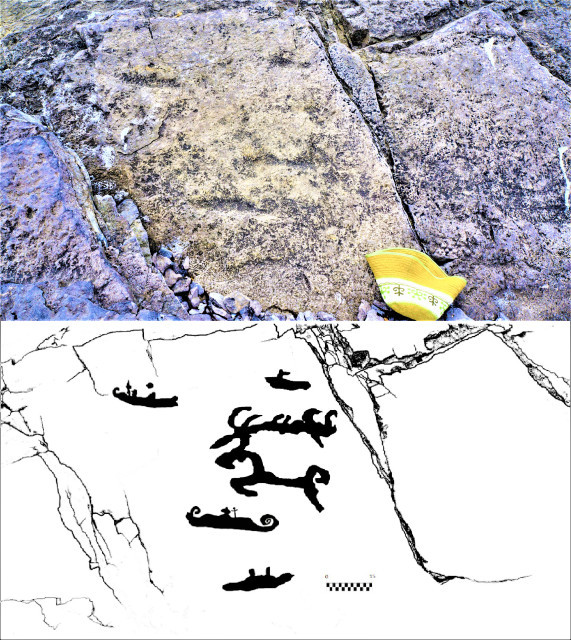
Petroglyphs and their trace drawing. Photo: Igor Bondar
Shulgan-Tash is on the UNESCO World Heritage List
The rock paintings of the Shulgan-Tash Cave in Bashkiria have been known for a long time. Scientists have even roughly determined their age — 20,600–16,500 years. It is the largest and best preserved monument of cave painting from the Upper Paleolithic period in Eastern Europe.
The cave itself was described by scientists at the end of the 18th century. In 1959, zoologist Aleksandr Ryumin saw silhouettes of ancient animals on the stone walls: mammoths, rhinoceroses, bison, horses, camels, as well as mysterious anthropomorphic figures and geometric symbols. The authenticity of the images and their Paleolithic age were confirmed in September 1960 by the work of the Ural Paleolithic Expedition of the Institute of Archaeology of the USSR Academy of Sciences led by Otto Bader.
The decision to include the unique rock art of the Shulgan-Tash Cave in the UNESCO World Heritage List was made at the 47th session of the corresponding UNESCO committee, which was held in Paris in July.
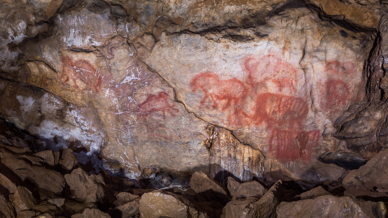
Prehistoric drawings in the Shulgan-Tash Cave. Photo: Oleg Menkov, participant of the RGS’s contest "The Most Beautiful Country"
The restoration of Remezov’s map has been completed
The complex process of restoration of the ancient cartographic document «Large Chart of Siberia» (1698) has come to an end.
Its author is the isographer, architect, cartographer, and historian Semyon Remezov. The canvas, measuring 213 cm in height and 277 cm in length, was for a long time in the office of the buyer of the work, the Russian Emperor Pyotr I. From 1947 to 2007, Remezov’s map was exhibited in the Pyotr I Gallery of the Hermitage. Now it is the pearl of the Cartographic Collection of the RGS. It was a matter of honor for the RGS to put it in order, namely, to carry out a full-fledged restoration. And now the big job is over.
«Having gone through a difficult path of scientific study, technological, historical, and archival research, as a result of the restoration, the drawing reveals to scientists many features of native Russian cartography, since it is the only preserved monument of this type of Russian cartography,» said Egor Orlov, head of the Cartographic Collection of the Russian Geographical Society.
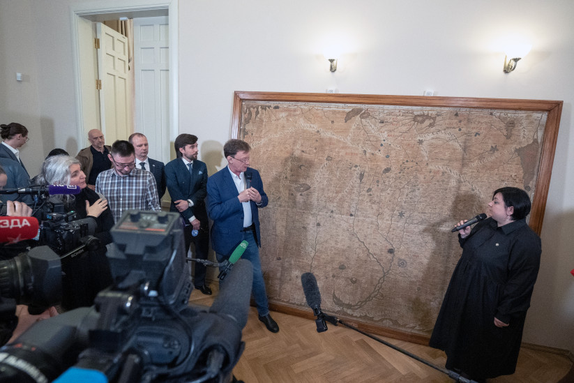
Remezov's map. Photo: Vladimir Neskoromny / RGS press-service
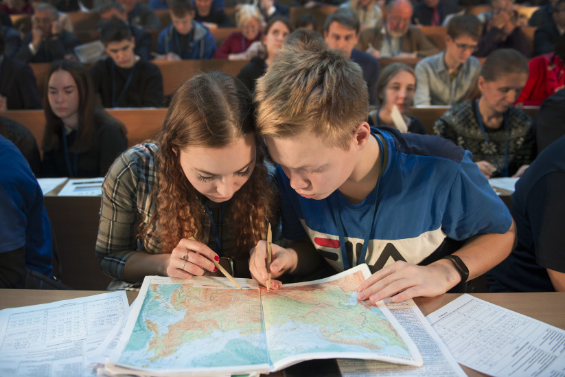
There will be a new geography textbook
Work has begun on the creation of a new school geography textbook. This instruction was given by Vladimir Putin following the results of the XVII Congress of the RGS and the meeting of its Board of Trustees on October 23.
More precisely, we are talking about a single state line of school textbooks on geography. It is assumed that there will be two sets: for students from 5th to 9th grade and from 10th to 11th.
The idea of creating a set of textbooks has been discussed by experts of the RGS for a long time. This will be a fundamentally new textbook that will become the foundation for rethinking the entire school course, update the content of the subject, and form a new generation of citizens with deep knowledge of their country and the world, as well as a developed sense of patriotism.
Textbook maps and atlases should correspond to the modern borders of the Russian Federation. Leading Russian scientists of the Russian Academy of Sciences have been involved in the work, and it is planned to use the enormous scientific and expeditionary experience of the Russian Geographical Society. The work is coordinated by Nikolai Kasimov, First Vice-President of the RGS.
The President of the RGS, Sergei Shoigu, announced the appearance of new textbooks by 2028.
«Geography should arouse interest and pride in your country,» he said.
Work has begun on the creation of a new school geography textbook. Photo: Nikolai Razuvaev