Global warming is rapidly changing the face of the Arctic. Melting of perennial ice distorts the outlines of existing geographic objects and forms new islands, capes, straits. This process is becoming so fast that it is more and more difficult to follow it and update the maps. But is also more exciting – nature sometimes gives geographers complex riddles. So, the history of changes of Eva-Liv Island in the Franz Josef Land Archipelago can be called a real geological detective.
Cape Mesyatsev, which existed here not long ago, was separated by a wide strait from the mainland. For some time, the area of the new island was rapidly decreasing, and in the summer of 2021, its surface in space images changed color from the usual white to dark. This made the specialists of the interregional group "RISKSAT", under the leadership of associate professor at Moscow Aviation Institute, Candidate of Technical Sciences Alexei Kucheiko, to assume that bedrock has come to the surface. Does this mean that the island will stop shrinking? It turned out to be not so simple.
– Alexey Anatolyevich, how long has your group been watching Eva-Liv Island? Who does it and how? What data is used for this?
– We have been observing the island with the beautiful name Eva-Liv since 2019 using satellite images from the archives of open Earth remote sensing data(ERS). The interregional group includes schoolchildren and students who study technologies for processing satellite images for project research on various topics related to ecology, nature conservation, the consequences of accidents and emergencies. The group has already managed to discover new islands that have appeared in the Arctic as a result of melting and destruction of glaciers, previously unknown and poorly studied haulouts of the Red Book walruses in the Laptev Sea, to study the consequences of accidental oil spills in the Black Sea, to identify the location of unauthorized dumps and quarries, and much more. The group cooperates with the Hydrographic Service of the Northern Fleet, the Russian Geographical Society, the Investigative Committee of Russia, nature reserves, institutes of the Russian Academy of Sciences, and other partners. The new islands discovered near Novaya Zemlya have been confirmed by the expeditions of the Northern Fleet hydrographers and detailed photographs from Roskosmos. Mastering and practical application of space imagery technologies contributes to social adaptation, a conscious choice of a profession and the formation of an active life position among young people.
Фрагмент презентации группы "РИСКСАТ"
– When did it first become known that Cape Mesyatsev had turned into an island, and how long ago, in your opinion, did this process begin?
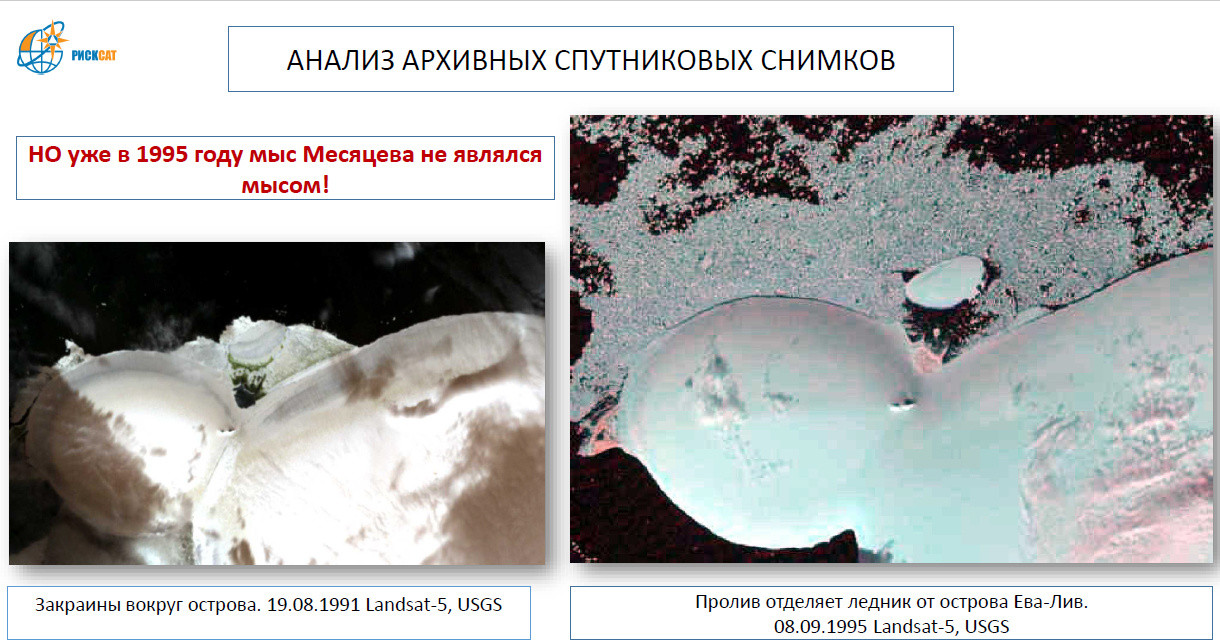
– Messages about the transformation of Cape Mesyatsev into a new island off Eva-Liv Island appeared in 2018, when polar scientists from the expedition "Open Ocean. Arctic Archipelagos" on the yacht "Alter Ego" passed a new strait 5-6 meters deep. The fact of the appearance of a new island instead of a cape was also confirmed by the hydrographs of the Northern Fleet. We decided to use satellite images to find out when the cape turned into an island and what is the dynamics of glacier degradation. The study was carried out by the schoolchildren from the city of Venev Polina Isakovskaya and Vladislav Solovyov in 2019 (now they are students of universities in the city of Tula). It turned out that Mesyatsev Island, covered with a domed glacier, separated from Eva-Liv Island back in the 1990s. So, in the photo from September 8, 1995, it can be seen that the island is separated by a strait with clear water. The melting and reduction of the area and mass of the ice dome, which formed the basis of Mesyatsev Island, had begun. According to the researchers, the destruction of the ice bridge was accompanied by an increase in the number of summer seasons, when the boundary of perennial ice receded northward from the Belaya Zemlya Archipelago (a group of islands in the north of the Franz Josef Land Archipelago). According to satellite observations, in the 1970s – 1980s, open water around the islands of the Belaya Zemlya group was observed one or two summer seasons per decade and already seven summer seasons in the 2010s.
– How quickly did the shape, area and height of the island change? What will happen to it in the future?
– During the 2010s, the glacial dome, which formed the basis of Mesyatsev Island, had undergone significant degradation. The glacier was shrinking like the magic skin. Measured from the images, the reduction rate of the glacier area was from 5 to 13 hectares per year. The height of the ice dome at Cape Mesyatsev was 22 meters according to 1985 maps and 17 meters on Mesyatsev Island according to satellite measurements in 2017. The glacier became flat according to photographs taken by members of the MSU expedition in the summer of 2021.
According to schoolchildren's calculations, the glacier island, whose area had decreased from 110 hectares in 2010 to 15 hectares in 2020, should disappear in the summer of 2022. According to estimates received by Elizaveta Lisachenko from Troitsk (now a student at the Faculty of Geography of Lomonosov Moscow State University), the glacier lost another eight hectares in 2021, and in September its area was only seven hectares, which is quite comparable with the average annual area of ice loss in previous years. This once again confirms the forecast of the disappearance of the glacier in the coming summer.
"Потемневший" остров на космическом снимке. Фрагмент презентации группы "РИСКСАТ"
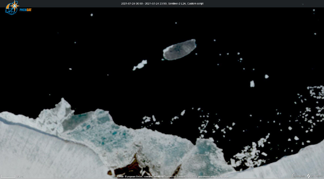
– What happened to Mesyatsev Island in 2021? Why did it change color?
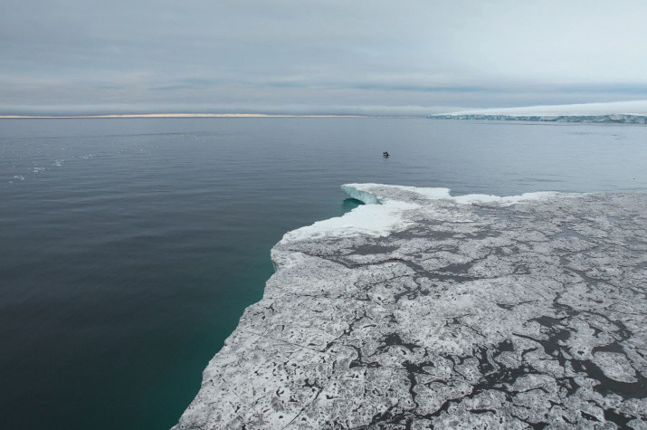
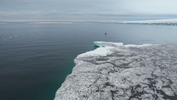
– In July 2021, as the snow cover melted, the appearance of the glacier island had changed. Its color changed to dark gray, which made it possible to put forward a hypothesis about the melting of the ice sheet and the emergence of bedrocks on the surface. We promptly prepared materials about the island and sent them to our partners who were preparing for summer expeditions. In 2021, three expeditions visited the islands of the Belaya Zemlya group at once: the yacht "Alter Ego", and the research ships "Ivan Petrov" and "Akademik Tryoshnikov". The scientists landed on a cape in Kapriznaya Bay (two kilometers south of Mesyatsev Island) and surveyed the island using a drone. It turned out that it was covered with a layer of dust, which was intensively washed away by streams of melt water. September 2021, a significant part of the dust cover had already been washed away, and the island's area continued to decline rapidly.
– What are the hypotheses for the "dusting" of the island put forward by the scientists?
– We had several discussions to identify the sources of the dust found on the island in 2021. The scientists have expressed opinions that can be reduced to two main versions: wind transport and melting of the "dust layer". The source of dust, which covered the surface of the glacier of Mesyatsev Island because of strong winds probably at the end of 2020, could have been a cape in Kapriznaya Bay, formed by melt water from the glacial domes of Eva-Liv Island. Examples of such dust eddies can be observed, for example, in satellite images of Alaska’s glaciers.
According to another version, glaciers-domes have a layered structure in which a thousand-year history of their formation is recorded. That includes the layers formed by the fallout of dust, for example, due to strong volcanic eruptions. A chemical analysis of samples collected from the surface of the glacier could solve the mystery of the origin of the dust. We continue to watch his fate.
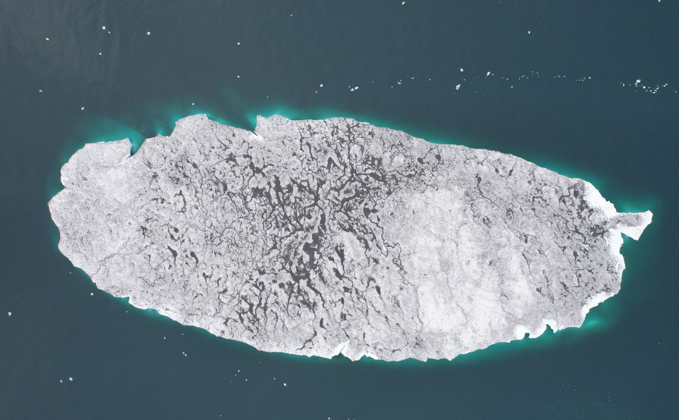
Остров Месяцева, снимок 2021 года с дрона. Фото: Александра Барымова/Центр морских исследований МГУ имени Ломоносова
Glaciologist Andrei Glazovsky from the Institute of Geography of the Russian Academy of Sciences admits that pollution of the surface of Mesyatsev Island could be the result of both thawing of ancient dust layers and fresh dust. In his opinion, these dust particles most likely came to the glacier from a local source, and not volcanic or distant one. They were here in the form of a contaminated layer (or layers) of ice and, when melted, accumulated on the surface of the glacier.
“Based on the photographs, this is probably fine soil that concentrates on a relatively flat surface as the ice dome melts, containing small particles blown onto it by the wind. About two kilometers to the south (on the isthmus of the island of Eva-Liv) is an earthen promontory, which, I believe, is the main source from where they were blown away.
Alexander Zhirnov