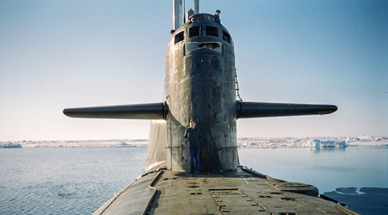
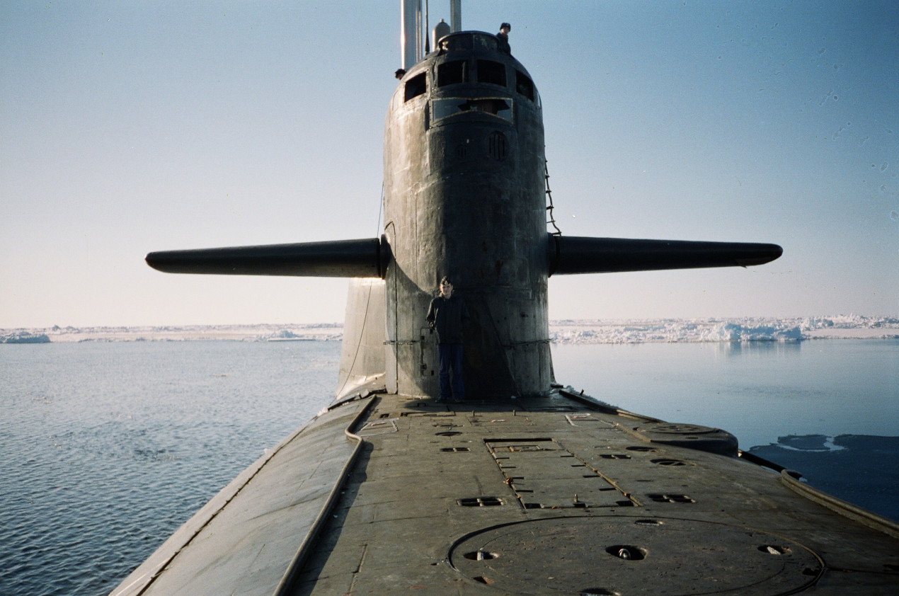
The K-496 submarine. Photo: Aleksey Kornis
On March 19, Russia celebrates Submariner Day. In addition to making a tremendous contribution to ensuring the defense capability of our country, representatives of this elite military profession have done a lot for maritime geography. And sometimes they became real pioneers. One of these episodes is described in an article by a participant in the events, now the scientific director of the complex expedition of the Northern Fleet and the Russian Geographical Fleet «Remember the War», Captain 1st rank Aleksey KORNIS.
An important scientific achievement of complex oceanographic research using the submarine fleet, which began in the USSR in the 1960s, was a qualitatively new understanding of the geographical objects of the ocean and their deep geological structure. After the work, not only were the depth and isobaths displayed on the survey sheets and maps, but the information mistakenly applied by the predecessors was also «erased».
A number of objects discovered during autonomous navigation have received their own names. The most famous case in this regard is the discovery of seamounts in the Greenland Sea by the submarine K-496 under the command of Captain 1st Rank Andrey Volozhinsky in 1997.
The oceanographic work from the submarine was planned to fulfill the Soviet plans to explore the Arctic. In the area between Greenland and Svalbard, where the Yermak Plateau and Lena Valley are located, all maps showed only individual depths obtained as a result of episodic voyages by Soviet nuclear submarines and icebreaker-type vessels, as well as the drift of some polar stations (Papanin was somewhere here in 1937 on the famous North Pole-1). There was simply no clearly defined underwater relief; only individual isobaths were barely dotted in some areas of the planned area. If there is a concept of a «black hole» in space for such a state of uncertainty, then for the ocean this geographical void is expressed more flatly, a «blind spot». On an area of about 31,000 square kilometers, the depths mapped on a scale of 1:500,000 were very few.
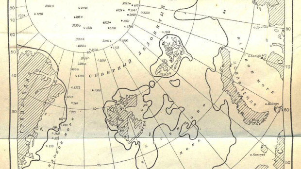
Information on depths in the Arctic before the start of large-scale oceanographic research as of the early 1950s. Photo from the archive of Aleksey Kornis
The K-496 strategic missile submarine entered this «aqua incognita» in early June 1997. By the way, it was this submarine that unofficially became the record holder of the Soviet and Russian fleets in the number of dives under the ice.
The senior officer of the voyage was Captain 1st rank Vladimir Nazarov, the deputy commander of the division, who shared equally with the commander and senior assistant Nikolai Gritsevich the burden of commander’s watches.
Senior Lieutenant Aleksey Kornis led the complex oceanographic group, and Senior Lieutenant Leonid Kulakov was directly responsible for the survey.
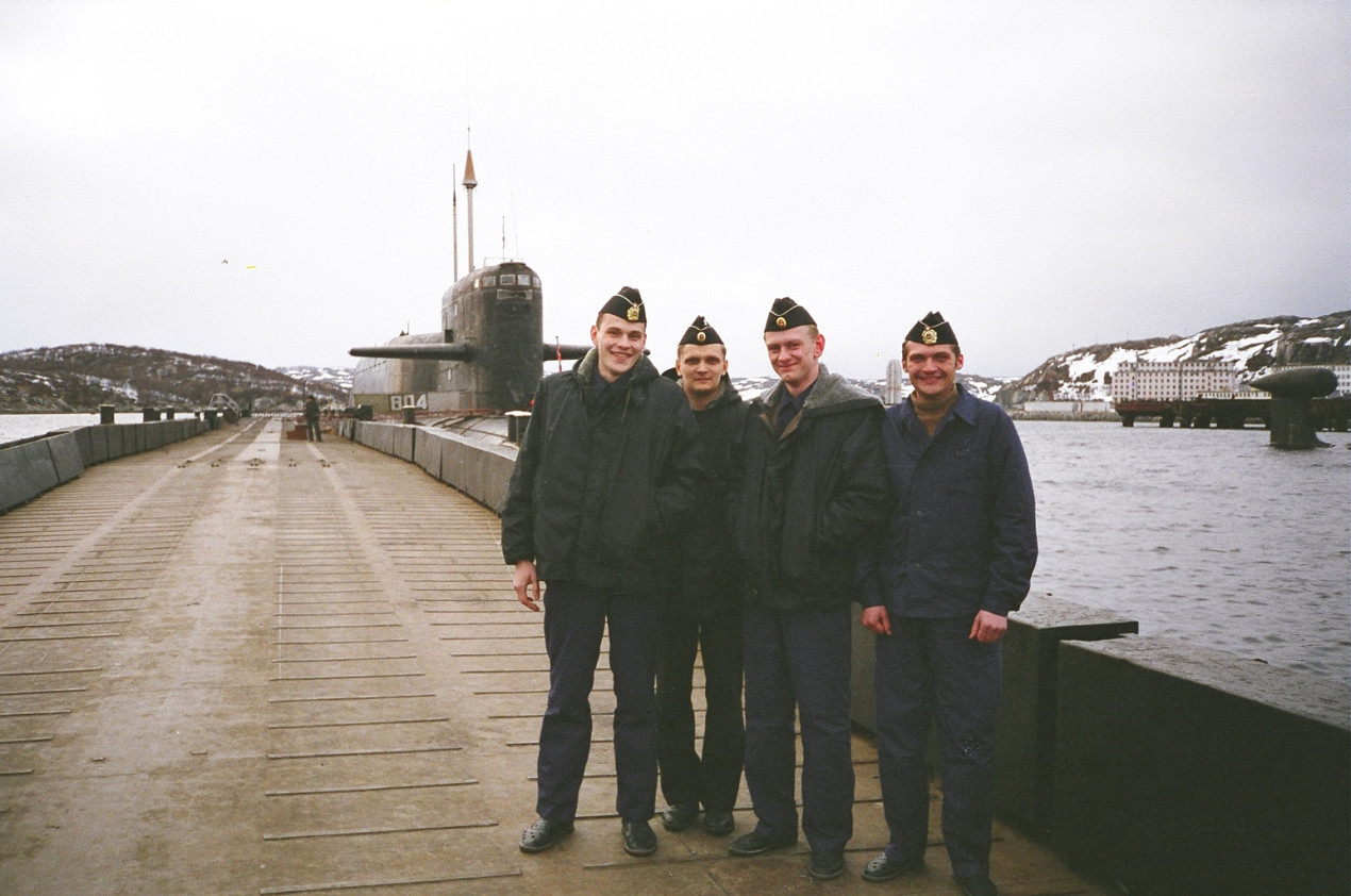
Part of the hydrographic group on K-496 (from left to right: Demshin, Kornis, Kulakov, Anokhin), 1997. Photo from the archive of Aleksey Kornis
The difficulty of the voyage also consisted in the fact that there was ice above the submarine carrying out combat service tasks, the depth of the underwater part of the hummocks of which, measured by underice sonar, ranged from 10 to 25 m. There was another feature. The fact is that in order to improve the accuracy of the bottom relief survey, the command of the boat took a certain risk by increasing the frequency of ascents to determine the location using satellite navigation systems. At the same time, in the ice-holes, that is, when appearing on the surface, they had to surface five times in different parts of a given area! Only experienced submariners know what it means to lift an underwater cruiser with a displacement of about 20,000 tons without running at a speed of less than 4 cm/s. Readers can only guess what the ship’s crew experienced when they brought the boat out of the silent depths onto an equally silent surface.
There were 15 such «sub-ascents» (and in fact, full-fledged ascents) to determine the place in the voyage.
The area was covered day after day by a system of parallel tacks, based on the distances set by the scientific and technical project. Somehow, it turned out that the crew embraced the idea of conquering the unknown with each passing day of autonomous navigation more and more. Each combat shift tried to make the «blind spot» even smaller, «eating it up» with another number on the survey sheet.
A total of 5,157 km of measurements were carried out, of which 267 km accounted for the examination of the distinctive depths identified during the voyage, of which there were no fewer than 22. There was also a 900-meter depth among depths of 2500 m, and a depth of 1500 m among four-kilometer isobaths.
As a rule, there is no time for additional study of these «bursts» on echograms on such trips. But this time, by the minute, they managed to collect the whole day between the time of completion of work and the time of departure from the designated area. After additional study of the correlation of the bottom relief with the gravimetric field, for the first time in the history of ocean exploration from submarines, it was decided to survey two newly discovered depths by increasing the survey tacks. No one in the world had done this before 1997.
As a result of the additional survey of the bottom relief, two seamounts with a height of more than a kilometer and a base area of about 100 square kilometers each appeared on the map.
These were real discoveries! And although no one, of course, shouted: «Land!», the wonderful feeling of knowing the unknown and at the same time a special euphoria touched the heart of even the most seemingly indifferent, only recently dreaming of discharging conscript sailor.
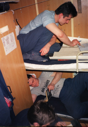
In the hydrographers' cabin. On the upper bunk, the echogram received is being reviewed, on the lower bunk, a brief moment of rest before the watch. Photo from the archive of Aleksey Kornis
Back in the autonomous navigation, it was decided to assign the names of the general designer of the first Russian nuclear submarine Vladimir Peregudov (1986 m) and the first commander of the first K-3 nuclear submarine of this project Leonid Osipenko (2,106 m) to the seamounts.
The idea was floating around the navigator’s cabin of the cruiser. Besides, from a shelf with various useful literature, it was constantly fueled by a book, which, possibly, was called «Morskaya karta rasskazyvaet» (eng. «The Sea Map Tells»). When it came time to explore the distinctive depths, the idea took shape somehow by itself. And the history of K-3 and K-496 was too intertwined.
The godfathers of the name were Leonid Kulakov, commander of the hydrographic group, and Andrey Volozhinsky, commander of the cruiser.
There was no way to review the legislation on this issue during the autonomous navigation, and therefore it was decided that, by the right of the discoverers and in accordance with the traditions of the Russian navy, the final choice of names should be made by the general meeting of the crew.
Here, by the way, a funny incident occurred. The submariners, who were kindly, sometimes a bit on purpose, encouraged by hydrographers to conduct the research, got so carried away with the naming that they forgot to invite those who documented the very existence of these mountains for the first time, the members of the expedition group (it was still working at that moment) to the event at which the options proposed by the command were approved. The researchers, of course, did not object to the names at all, especially since the commander almost immediately apologized to the senior of the expedition group for making a «political miscalculation.» The hydrographers respected him even more for this moment, because the commander of a strategic missile submarine was almost the «first authority after God», and then there were young officers who had recently graduated from college.…
Relevant notes were made about the officers' meeting and naming in the K-496 navigation and logbook, as well as in the ocean survey sheet.
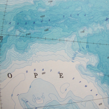
A fragment of the map with the geographical features in the Lena Valley found during the research by the K-496. Photo from the archive of Aleksey Kornis
But it just so happened that in the troubled 90s, names were not put on the maps. Somewhere, the slowness of the government was in the way, somewhere it simply had other things to worry about, and somewhere there was also the conviction that if you send a proposal to the authorities, then sooner or later it will be the highest decrees by itself.
When, at the beginning of the first decade of the 21st century, the documents finally got to the Rosreestr authorities, the names had to be changed. The reason: the mountains are located in a foreign economic zone, and the relevant supranational authorities, which were supposed to make the final decision on the names, could not approve the «militaristic» names (this is a quote from the direct speech of the then officials). Other, more «neutral» names were proposed for these objects: those of Konstantin Korotaev, former head of the Hydrographic Service of the Northern Fleet, and Vasily Danilchuk, a hydrographer who served in the Northern and Baltic Fleets for many years. These names were finally approved in Beijing on September 12–16, 2011 by the relevant decision of the Intergovernmental Oceanographic Commission at UNESCO and the International Hydrographic Organization.
However, the work on perpetuating the memory of Peregudov and Osipenko has not ended. Thanks to the efforts of the expedition participants and enthusiasts who supported them at various levels, in 2014 other geographical objects in the exclusive economic zone of the Russian Federation in the Barents Sea were named after Peregudov and Osipenko.
Thus, as a result of the voyage of the K-496 submarine, the names of four of our compatriots who made an undeniable contribution to the formation of Russia as a maritime power appeared on domestic and international maps. After the 1997 work, the «blind spots» in this area disappeared, and some distinctive depths, including Mount Korotaev (Peregudov), appeared on a 1:2,500,000 scale map of the Arctic, which most fully reflected the bathymetric picture of the bottom relief obtained by Russian hydrographers.