

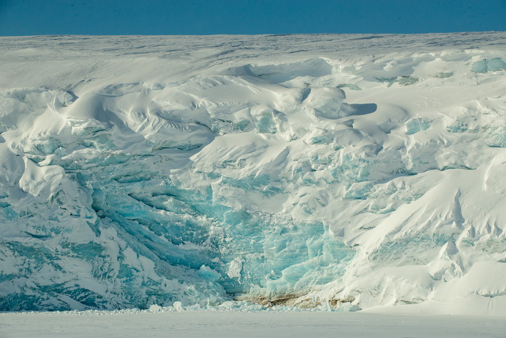
The Lunny Glacier from Cape Dezhnev. Photo: Vadim Shtrik, GeoPhoto
The first stage of the comprehensive scientific expedition of the RGS and Russian Arctic National Park to Franz Josef Land has ended. For 10 days, glaciologists, geophysicists, and biologists analyzed the dynamics of melting glaciers, explored the underwater world of the island of Alexandra Land with drones, and monitored the geomagnetic situation over the Arctic. Now, we’ll summarize the results and tell you about the plans for the summer.
The ice chronicle as a witness to the changing climate
There are two large glacial domes located on the island of Alexandra Land, Kropotkin and Lunny. The latter rises almost 400 m above sea level. It is one of the five longest glaciers in the Franz Josef Land archipelago. Its considerable height and length, as well as its location in the western part of the archipelago, make it interesting from the point of view of research. There may be unique stratigraphic layers that do not contain traces of melting and contain a climate signal. Stratigraphic layers are layers of rocks, soils, or sediments that are formed during the geological or climatic evolution of the Earth.

Glaciological research. Photo: Vadim Shtrik, GeoPhoto
Such layers in glaciers contain information about the climate and chemical composition of the atmosphere of the past. The composition of the atmosphere is formed as a result of the contribution of both natural and anthropogenic sources. Their dynamics and nature can be investigated by analyzing glacial cores. These are ice samples that scientists take for research.
«The expedition completed all the tasks: from reconnaissance drilling of glaciers to monitoring glaciers and marine ecosystems, » says Aleksandr Kirilov, expedition leader and director of Russian Arctic National Park. «The data obtained will form the basis for models of climate change and radio wave propagation in the Arctic. The next stage is in-depth research, including full drilling of the Lunny Glacier and expansion of hydrobiological monitoring.»
During the expedition, glaciologists from the Institute of Geography of the Russian Academy of Sciences (IG RAS) conducted core drilling and geophysical studies on both glacial domes. Firn, an intermediate layer between snow and dense ice, was found in the cores obtained on the Lunny. Its presence shows that this glacier can potentially serve as a valuable natural archive.

«The task of our current expedition is reconnaissance, » says Aleksandr Dobryansky, an employee at the IG RAS. «We drilled 10 meters into the dome of the Lunny Glacier to understand whether it has preserved the climate signal and data on past events in its structure. These can be volcanic eruptions and other natural processes. Preliminary results show this possibility. The final answer can be given after processing the collected samples in the laboratory: studying the isotopic composition, chemical impurities, and the layered structure of the ice. Such data can tell you what the temperature was in this region hundreds of years ago. Due to this, it is possible to predict the rate at which the Arctic is warming. And this, accordingly, will tell you how the average daily temperature, water temperature, and a number of other factors critical for navigation will change».
With the help of ground-penetrating radar, scientists have clarified the thickness of ice and snow on the island of Alexandra Land. In addition, the new methods also show the subglacial relief –s all the surface irregularities that are hidden under the ice. The shape of the subglacial surface directly affects how the glacier moves and melts. For example, in mountainous areas, ice slides faster and water can accumulate in depressions. These data also help scientists predict how glaciers will behave in the face of global warming.
Polar space weather
Scientists at the Space Research Institute of the Russian Academy of Sciences (IKI RAS) have developed a digital model of the Earth’s ionosphere. This model helps to study space weather, for example, magnetic disturbances that affect communications and navigation. In order to improve this model, geophysicists went to the island of Alexandra Land.
Specialists from the Moscow State University of Geodesy and Cartography have developed special software for monitoring the ionosphere and the upper atmosphere. In order to obtain data for research, which is then processed by the program, the scientists took the GNSS satellite station on the expedition. This device receives signals from navigation systems (GPS, GLONASS, etc.) to determine accurate coordinates, and for scientific purposes, to analyze the state of the ionosphere by measuring signal delays.

Albert Yanakov during the installation of equipment. Photo: Vadim Shtrik, GeoPhoto
These methods need to be tested in the Arctic, where proximity to the magnetic poles, auroras, and extreme conditions distort signals, affecting the accuracy of satellite navigation, communications, and forecasting of geomagnetic disturbances. The measurements obtained help not only to correct the ionospheric model, but also to improve the ways of predicting its state.
«Monitoring and forecasting space weather is critically important for the safety of the Northern Sea Route,» explains Albert Yanakov, Head of the Arctic Heliogeophysics Center of the IKI RAS. «Ionospheric disturbances cause navigation and radar failures, and disrupt radio communications. Operational data improves the forecast of the state of the ionosphere and helps to take into account interference in communication, navigation, and radar technologies, adjust routes and minimize risks to Arctic navigation, expeditions, and life in hard-to-reach areas of the Arctic.»
Underwater exploration
Hydrobiologists from the Russian Federal Research Institute of Fisheries and Oceanography (VNIRO) conducted field research in the coastal waters of the island of Alexandra Land. As part of the expedition, seven temporary stations were installed, where experts took samples of zooplankton, phytoplankton, and benthic organisms, and also recorded the main hydrological parameters.
Franz Josef Land from the air. Photo: Vadim Shtrik, GeoPhoto
«We measured the salinity and temperature of the water, collected samples of plankton, and examined the bottom. According to preliminary estimates, the underwater ecosystems of the region remain stable. There are a lot of shrimps and sea urchins here,» says Aleksey Labutin, senior specialist at VNIRO. «The state of underwater ecosystems helps to monitor climate changes, monitor the condition of commercial species and ensure the safety of navigation. Regular observations make it possible to quickly identify environmental threats, from oil spills to the melting of permafrost.»
Following the results of the expedition, scientists plan to conduct isotopic and chemical analyses of ice cores to clarify the climatic history of the region over the past decades. The results obtained will show the expediency of deep drilling using a mechanical installation.
«Traditionally, we have two stages of an expedition to the Arctic, » says Natalya Belyakova, Director of the Expeditionary Department of the RGS. «A comprehensive study of Franz Josef Land requires a seasonal approach. In spring (April-May), the key tasks are monitoring polar bears after they leave their dens and glaciological studies of snow cover. In summer (July-August) The focus is shifting to microbiological samples, studying plankton, and monitoring the melting of glaciers. It is this strategy, combining seasonal features, that provides the most complete picture of Arctic ecosystems.»
The expedition’s materials will become the basis for scientific publications and reports at Russian and international conferences. The work will continue within the framework of the Arctic Program of the Russian Geographical Society and with the support of the Russian Ministry of Defense.
The expedition was organized by the RGS in partnership with Russian Arctic National Park, with the participation of the IKI RAS, VNIRO, IG RAS, and the Institute of Physics of the Earth of the RAS.
Maria Buldakova