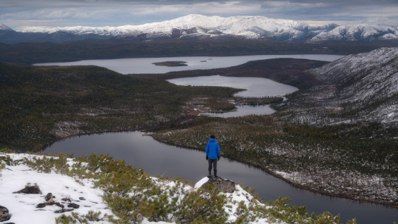
"Russian Alaska". Photo: Vladimir Lyapin, participant of the RGS's contest "The Most Beautiful Country"
The meeting venue between Vladimir Putin and Donald Trump, scheduled for August 15, is indeed very symbolic. It reminds us that Russia and the United States are neighbors, and our countries have a lot in common, even more than it sometimes seems. And Alaska itself has repeatedly featured in various projects of the Russian Geographical Society. Now is a good reason to remember them. But first, a short historical background.
The Discovery of Alaska
The width of the Bering Strait, which separates our countries (and continents), is 86 km. It is not surprising that it was Russian travelers who discovered this territory — unless, of course, we assume that long before the discovery, unsuspecting aborigines had lived there. In just a few days, it will be 293 years since the members of the crew of the ship «St. Gabriel» under the leadership of seaman Ivan Fedorov and surveyor Mikhail Gvozdev became the first Europeans to set foot on the land of Alaska. On August 21, 1732, the members of the expedition landed at the westernmost mainland point of North America. The place was named Cape Gvozdev, but is now known as Cape Prince of Wales.
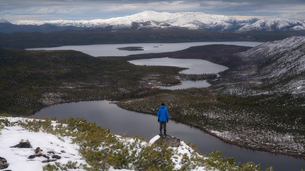
A map of new discoveries in the Eastern Ocean. Photo: wikipedia.org
However, there is information that the sailors from Semyon Dezhnev’s crew at least saw the coast of Alaska during the voyage in 1648, and perhaps even went ashore. Interestingly, modern archaeological research confirms the hypothesis that thousands of years ago, some of the tribes inhabiting Eastern Eurasia (that is, the current territory of Russia) migrated to America through the Bering Strait and now their descendants are considered the indigenous population of Alaska.
In 1741, Vitus Bering’s group explored the Aleutian Islands and the coast of Alaska during the Second Kamchatka Expedition. It was like a second, «conscious» discovery of it.
Russian America
The active development of America by Russians began in the 1780s. This was done by a company founded by merchant and industrialist Grigory Shelikhov, who was trading furs here. The company of another merchant, Pavel Lebedev-Lastochkin, competed with it. But the biggest contribution to the Russian colonization of America was made by Aleksandr Baranov, an entrepreneur and later the first Chief Manager of Russian settlements in North America.
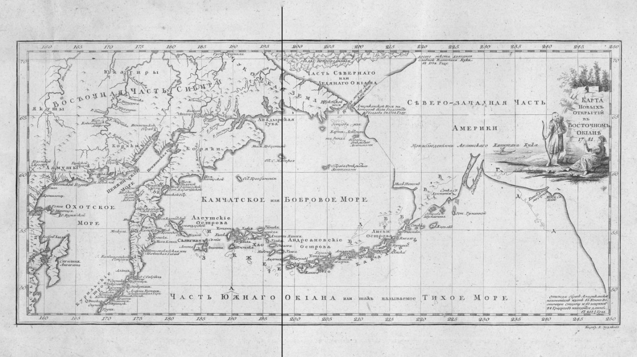
In 1799, he reorganized Shelikhov’s Northeastern Company into the Russian-American Company. From about this time, the concept of Russian America was consolidated. At first, these were settlements on Kodiak Island and the shores of the Cook Inlet, then Novorossiysk appeared on the coast of Yakutat Bay, and in 1799 Baranov founded Novo-Arkhangelsk (now Sitka), a full-fledged city that became the capital of Russian America a few years later. Later, several more redoubts appeared in Alaska. And Russian America acquired land in other states of the current United States — in California (Fort Ross) and Hawaii (Fort Elisabeth).
The capital of the Russian-American Company in Novo-Arkhangelsk. wikipedia.org
It was from that time on that the Russian names were marked on the geographical map: the Alexander Archipelago, the islands of Baranov and Wrangel, the Shelikhov Strait, etc.
A Geopolitical Mistake?
In 1867, Aleksandr II sold Alaska to the United States. Back then, the territory of more than 1.5 million square kilometers cost $7.2 million.
Today’s assessments of that deal are almost unanimous: a geopolitical mistake. This became apparent after gold deposits were discovered in Alaska. Vladimir Obruchev also pointed out that by the beginning of the 20th century, mining of precious metal here had brought the Americans about $200 million.
However, the Russian emperor obviously had good geopolitical reasons for selling Alaska. The idea is attributed to Governor-General of Eastern Siberia Nikolai Muravyov-Amursky, who can hardly be called unintelligent or weak.
In the context of the global rivalry with the British Empire and the Crimean War that began in 1853 (essentially, a world war), it would be impossible to keep Alaska in the event of a very real British military expansion. This was a huge territory with a population of only 2,500 Russians, concentrated on the edge of the ocean, and up to about 60,000 potentially loyal Aleuts, Indians, and Eskimos — if anything had happened, with the level of military logistics at that time, there wouldn’t have been any help. And on the other side of the Bering Strait, Russia simply did not have sufficient resources to defend Alaska. The alternative was to sell this territory to the United States, which observed «friendly neutrality» during the Crimean War. By the way, it wasn’t just us who sold the territories of untilled America in those days. Under the terms of the famous Louisiana Purchase, France transferred 2.1 million square kilometers of territory in the center of the continent to the States. Today six states in their entirety and nine states in part are located there.
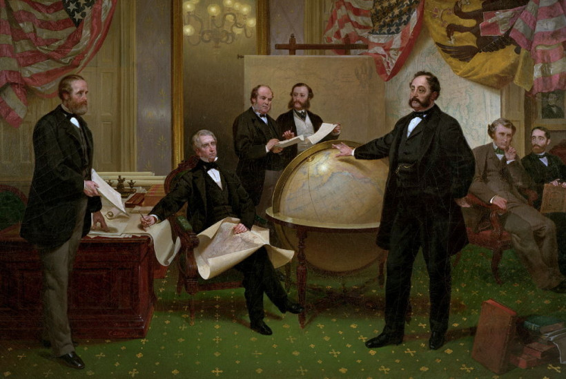
Emanuel Leutze. Negotiating the Alaska Purchase. Photo: wikipedia.org
Alaska Remembers
However, let tireless historians, armchair geopoliticians, and performers break lances on whether Aleksandr II did the right thing or not. It is important for us to preserve the memory of the Russian colonization of America and those brave and active people who explored Russia and the surrounding areas. There is a reason to recall the cooperation between our countries and even allied assistance in difficult times. Several projects of the Russian Geographical Society have been devoted to these historical and geographical aspects in the last decade.
Since 2008, the Ryazan Regional Branch of the RGS has been studying the historical and geographical heritage of Russian America. Since 2009, 13 scientific research expeditions have been conducted in Alaska, the Aleutian Islands, and Hawaii under the leadership of the famous traveler, Hero of Russia Mikhail Malakhov. For the first time since the sale of Alaska, the United States was able to see and explore about 22,000 km of territories discovered and developed by our compatriots. More than 50 remote settlements have been explored. Perhaps the most surprising fact is that for 150 years, Alaska has preserved a whole layer of Russian culture, in the absence of its representatives themselves.
The Documentary "Alaska: Notes from the New World"
Another project carried out with the support of the RGS is «Baikal — Alaska Expedition: the Path of Siberian Merchants». For the first time in more than 150 years, its participants recreated the route of the Russian pioneers from Irkutsk to Sitka. From 2013 to 2019, modern travelers traveled 15,000 km in several stages on an inflatable catamaran of their own design, sometimes dragging it on their backs.
By the way, on the Geoportal of the RGS, you can study «Atlas of the Northwest Coasts of America: from Bering Strait to Cape Corrientes and the Aleutian Islands», published in 1852. It took more than 20 years of fieldwork and cartographic surveys to compile it. The author is a hydrographer, later vice-admiral and governor of the Russian colonies in North America, Mikhail Tebenkov. The unique atlas contains information about the position of the coastline, types of shores, coastal relief and vegetation, in addition, the maps show the depths of some coastal areas.
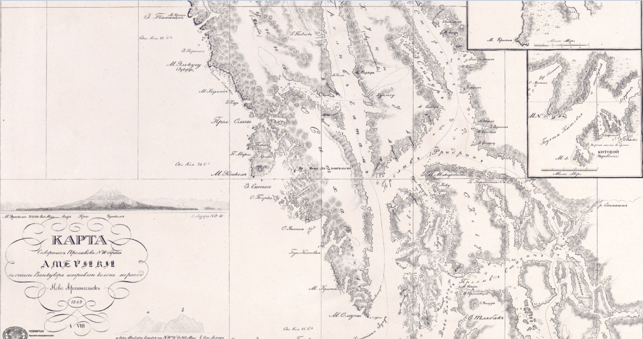
Map of the northern straits of the northeastern coast of America. Photo: Scientific Library of the RGS
The Geoportal brings together collections of historical, topographic, and special cartographic materials from the collections of the RGS and partner organizations. The cartographic collection of the RGS began to form from the moment of its foundation in 1845 and today has more than 48,000 unique atlases and maps.
One of the most prominent projects of the RGS in recent years has been the expedition along the now famous Alaska-Siberia Air Route, abbreviated ALSIB. During the Great Patriotic War, combat and transport aircraft were transferred along it. They were supplied under Lend-Lease from the USA to the USSR. Starting in September 1942, Soviet pilots ferried 8,094 winged machines across the Bering Strait along the ALSIB Air Route. The length of the air route from Fairbanks in Alaska to Krasnoyarsk was 6,500 km. In addition to Lend-Lease aircraft, non-military cargo, including food, medical equipment, and diplomatic mail, also arrived in the USSR via Alsib. Even the Vice-President of the United States, Henry Wallace, flew this route to the Soviet Union.
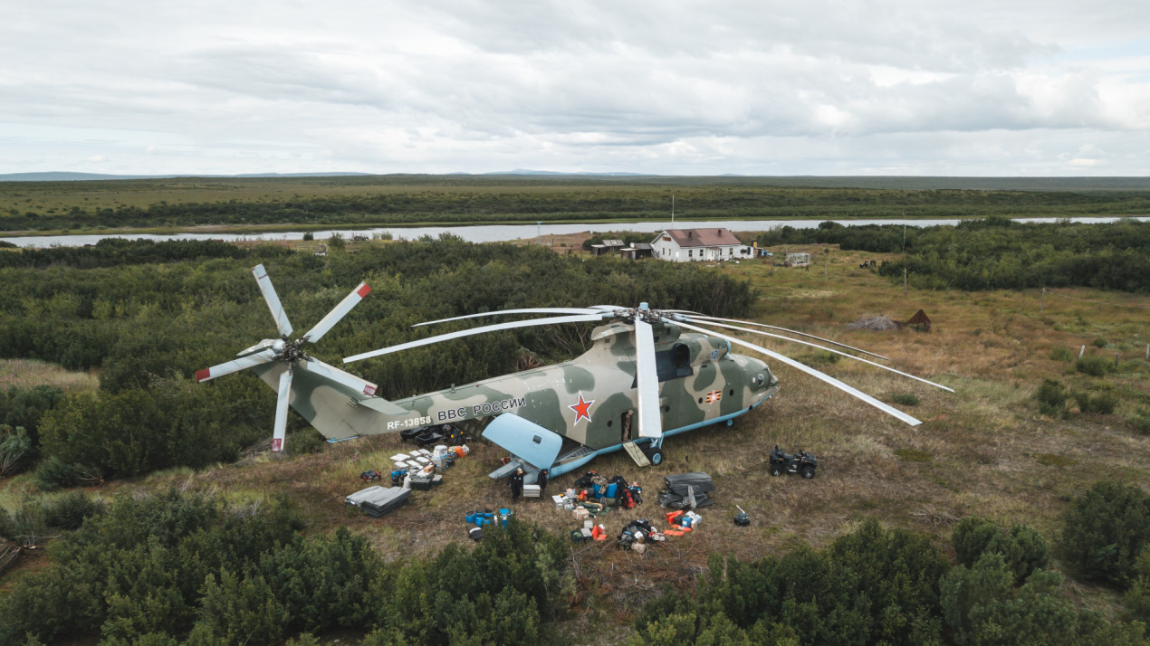
Expedition along the ALSIB Air Route. Photo: Aleksandr Bormotin
During the ALSIB expedition, from 2021 to 2023, its participants surveyed intermediate airfields, searched for aircraft lost as a result of plane crashes, and determined the fate of pilots.