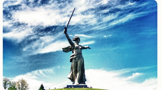
The Hero City of Volgograd. Photo: Natalya Malkina, participant of the RGS’s contest "The Most Beautiful Country"
This hill with a height of only 102 m above sea level is considered the main peak of Russia. And even geographers won’t argue with that. Mamayev Kurgan in Volgograd is a truly sacred place for everyone who was born in our country. It became the epicenter and symbol of the Battle of Stalingrad, a battle that historians call a turning point during the Great Patriotic War, and indeed the entire Second World War. It would seem that a typical area of the local landscape has turned into a completely different entity by the will of fate. In a sense, this piece of the earth’s surface was literally faceted by a battle between good and evil. And thanks to scientists, we can trace quite accurately how this happened and what the result was. On the eve of the 80th anniversary of the Victory, we examined Mamayev Kurgan from all sides together with geographer Yuri KNYAZEV, a member of the Volgograd Branch of the RGS, and Svetlana ARGASTSEVA, an employee at the Battle of Stalingrad Museum-Reserve.
— What is Mamayev Kurgan from the point of view of geomorphology?
Yuri Knyazev: The geographical features of Mamayev Kurgan were studied in great detail by Doctor of Geographical Sciences, Professor Viktor Andreevich Brylev (1940–2022). He, in particular, noted that this was a classic relief form of the southern part of the Volga Upland, which did not differ in any way from its «brethren». It is the erosive remnant of the Volga Upland isolated from three sides by rather steep slopes. It is confined to the denudation stage of the Maykop and Kiev clays and is riddled with numerous ravines and gullies. On the Volga side, it is bounded by rather steep ledges to the terrace associated with the Khvalyn transgression of the Caspian Sea (about 80,000–40,000 years ago). The waters of the transgression «cut down» the slope of the Volga Upland, forming an abrasion terrace at absolute elevations of +30–45 m. It was on it that Tsaritsyn was located, and later the central and northern regions of Stalingrad (Volgograd). The transgression entered the pre-Khvalyn gullies and small river valleys, expanding them and leaving brownish and grayish brown clays, which geologists and locals call chocolate.
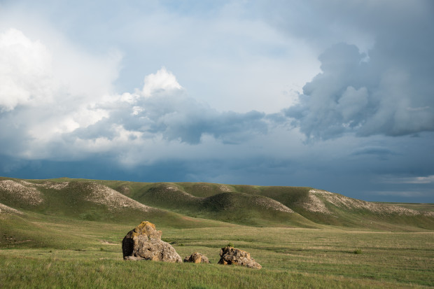
A typical relief of the Volgograd Region, the gully Bolshoy Kamenny sinkhole. Photo: Dmitry Sokhin, participant of the RGS's "The Most Beautiful Country"
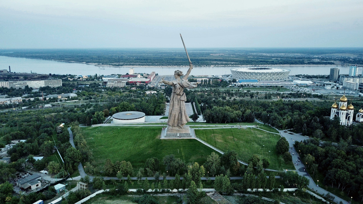
The kurgan is located a few kilometers from the city center. It is bounded by the Dolgiy and Krutoy ravines from the south, and Banniy from the north. There are many smaller ravines and gullies around, some of which are currently filled in. The modern height of the kurgan above the Volga River is 113 m; above the surrounding area, 60–70 m; above the level of the World Ocean, 102 m.
— Mamayev Kurgan is not the highest place in the area, why did it become strategically important?
— Yes, it is a low, double-peak hill which gained crucial operational and later tactical importance in the autumn and winter of 1942–1943 due to its advantageous position relative to the Volga. If it were a couple of kilometers farther from the Volga riverbed, there would simply be no panoramic view. That means it is the more or less high hill closest to the Volga riverbed: from its eastern foot to the riverbed, less than 400 m.
In addition, it offers a panoramic view of the northern and central districts of the city, including beyond the Volga River and the central Stalingrad ferry, which was used as a main supply route of Red Army units in the city center. It was the control over logistics that was crucial. The German army sank at least 270–280 ships at the crossing. The largest tragedy of this kind happened to the steamer «Joseph Stalin» (it is known by the film «Volga-Volga») on the night of August 26–27, 1942. Up to a thousand people died on it, mostly wounded.
Panoramic view from the kurgan. Photo: Anna Ushaneva, participant of the RGS’s "The Most Beautiful Country"
«The top was flat and unbeautiful. Young trees had been planted in rows. <…> there had been plans to lay out a park. Maybe someday it would be beautiful here, but so far there was little that was attractive about it. A few water towers, dried-up grass and an occasional prickly bush. But the view was really remarkable. The great sprawling city seemed to cling to the river, a cluster of new stone buildings, unwieldy, but appearing quite beautiful at a distance. They stood out like a small white island from a sea of wooden buildings. These tumbledown and windowless shacks straggled along the edge of the ravines, crept down to the river or clambered up the hillside, squeezing themselves in between the reinforced concrete blocks of buildings. The great smoky factories with the rumbling of cranes and the whistling of trains. 'Red October’, 'Barricades’, and far away, way beyond the horizon, the big buildings of the Tractor Works… There they had their own housing estates — white, symmetrical blocks of buildings and the little cottages with their corrugated tin roofs sparkling. And behind all this the Volga, peaceful and unruffled, so wide and restful, and on the other bank the curly greenery with little houses peeping out, and the violet distances…»
Viktor Nekrasov «Front-Line Stalingrad»
— You said that Mamayev Kurgan had originally been double-peaked?
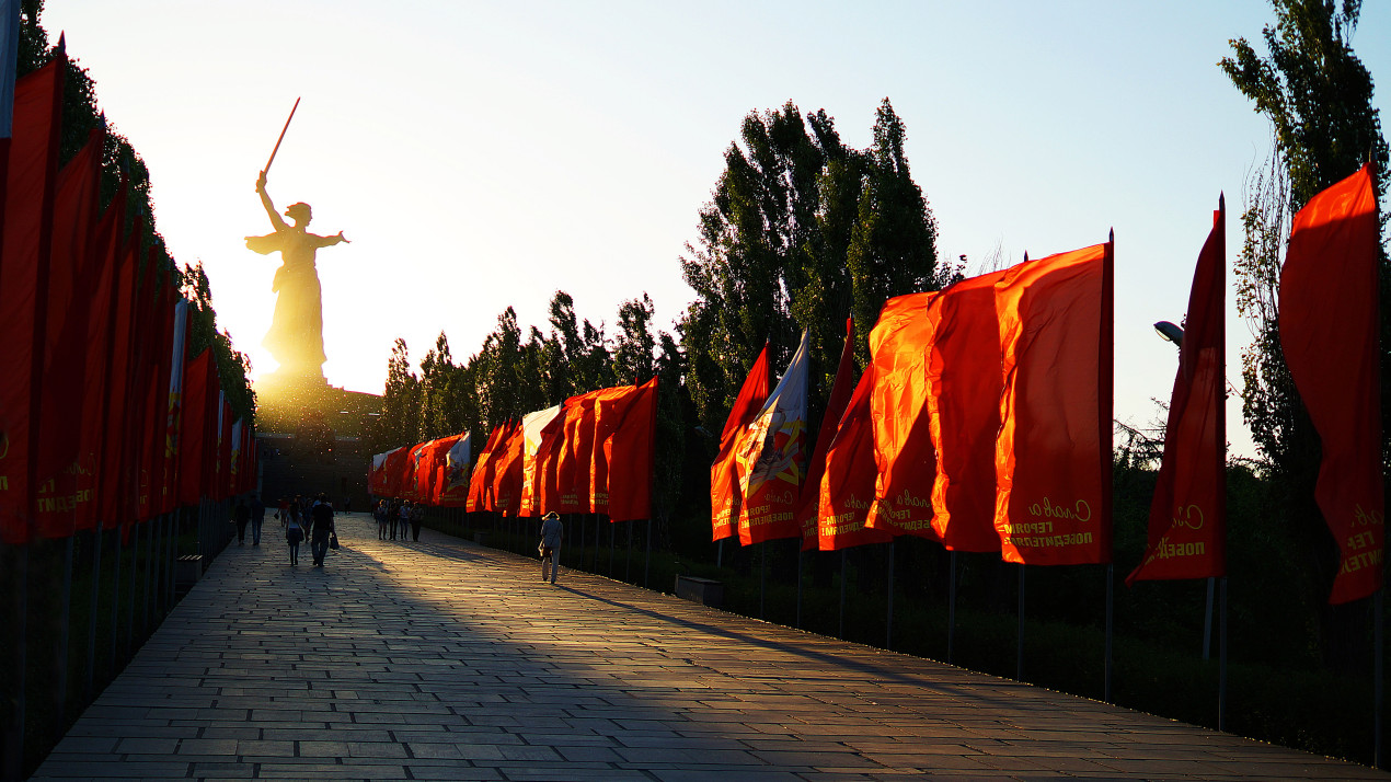
Svetlana Argastseva: Yes, but now the two peaks are no longer there. An artificial mound (up to 16 m high) in the upper part was used to level them. Today, the front part of this hill is a Large Mass Grave of Red Army Soldiers facing the Volga. The remains of 34,505 soldiers and commanders are buried in it. The foundation of the monument «The Motherland Calls» is also «embedded» in it. Its absolute height reached 102 m (now 16 m of artificial mound has been added), and it was listed on military maps as «Peak 102.0». The first peak of Mamayev Kurgan was located in the area of the modern Church of All Saints, the second, at the exit from the Hall of Military Glory to the Square of Sorrow (Grieving Mother).
— Mamayev Kurgan changed hands more than once during the Battle of Stalingrad. How did geographical knowledge help the defenders of the city?
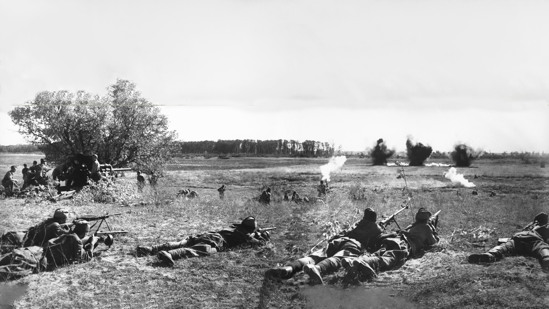
Yuri Knyazev: In 1942–1943, units of three fronts (Stalingrad, Southwestern, and Don) were concentrated on an area of about 80,000 square kilometers. They were located along natural borders: the valleys of the Don and Volga Rivers as well as their tributaries: the Kardail, the Myshkova, the Chervlyonaya, the Ilovlya, and others.
Small steppe rivers, large ravines, gullies played an important role in the conduct of battles, the deployment of infantry and tank troops. For example, a dense ravine network in the Large Don Oxbow prevented the advance of the German-Romanian troops. Ravines and gullies served as a good shelter and a serious obstacle to the movement of tanks. In addition, the mouth parts of the gullies, the alluvial cones in the vicinity of the Akatovsky and Kislyakovsky farms where there were water sources, became the location of field hospitals and camp kitchens for both Soviet and German troops.
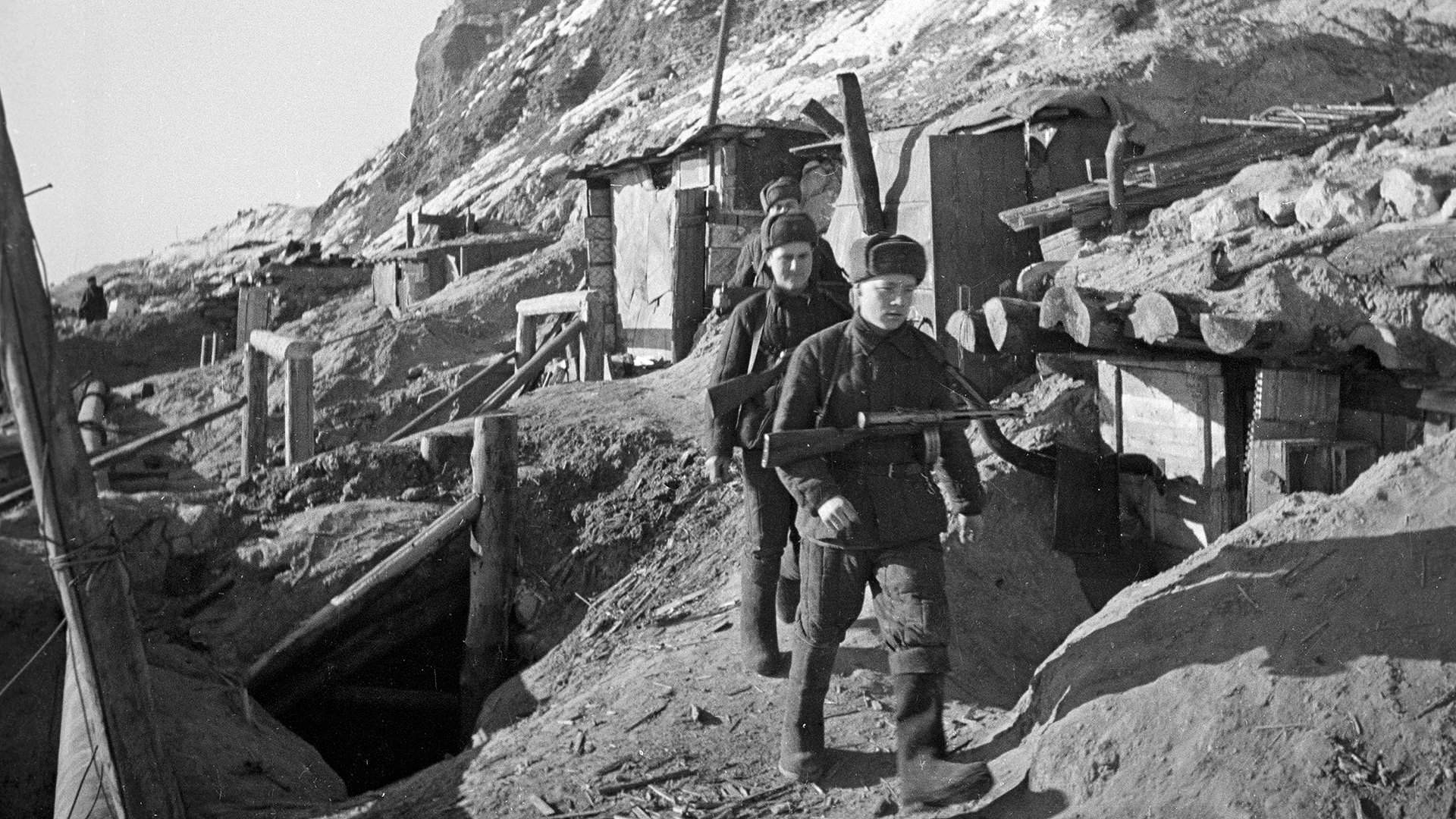
Here is what Aleksandr Vasilyevich Gorbatov writes about the ravine network of the Stalingrad area in his memoirs «Years Off My Life»: «I learned from the commander that his entire small company was here in the ravine. He justified his location by saying that the slope of the peak was very gentle, exposed to fire. You could bring food and ammunition to the company along the ravine, and it was better to retreat along the ravine in case of an enemy attack.»
In Stalingrad, the banks of the rivers Sukhaya Mechetka and Mokraya Mechetka, the Tsaritsa, the Kuporosnaya Balka, the Yelshanka, and others played a significant role. The ravine network running through the city blocks of Stalingrad was also used by the enemy. On September 14, the fascists reached the Volga along the gully of the Kuporosnaya and in the area of the Yelshanka. As a result of this the 62nd Army of Lieutenant General V. I. Chuikov and the 64th army of Lieutenant General M. S. Shumilov were cut off from each other.
In the central part of the city, the valley and slopes of another river, the Tsaritsa, became the enemy’s «breakthrough corridor» to the Volga. The defense of the estuary was conducted by sailors, and the water of the springs feeding the riverbed served as the only source of drinking water for both troops and residents. Another place where bloody battles were fought between the sailors of the Far East and the Germans was Banniy Ravine, which is open to fire from different sides, as the soldiers of the Battle of Stalingrad recall in their diaries.
— Nevertheless, the key geographical features during the battles are the hills.…
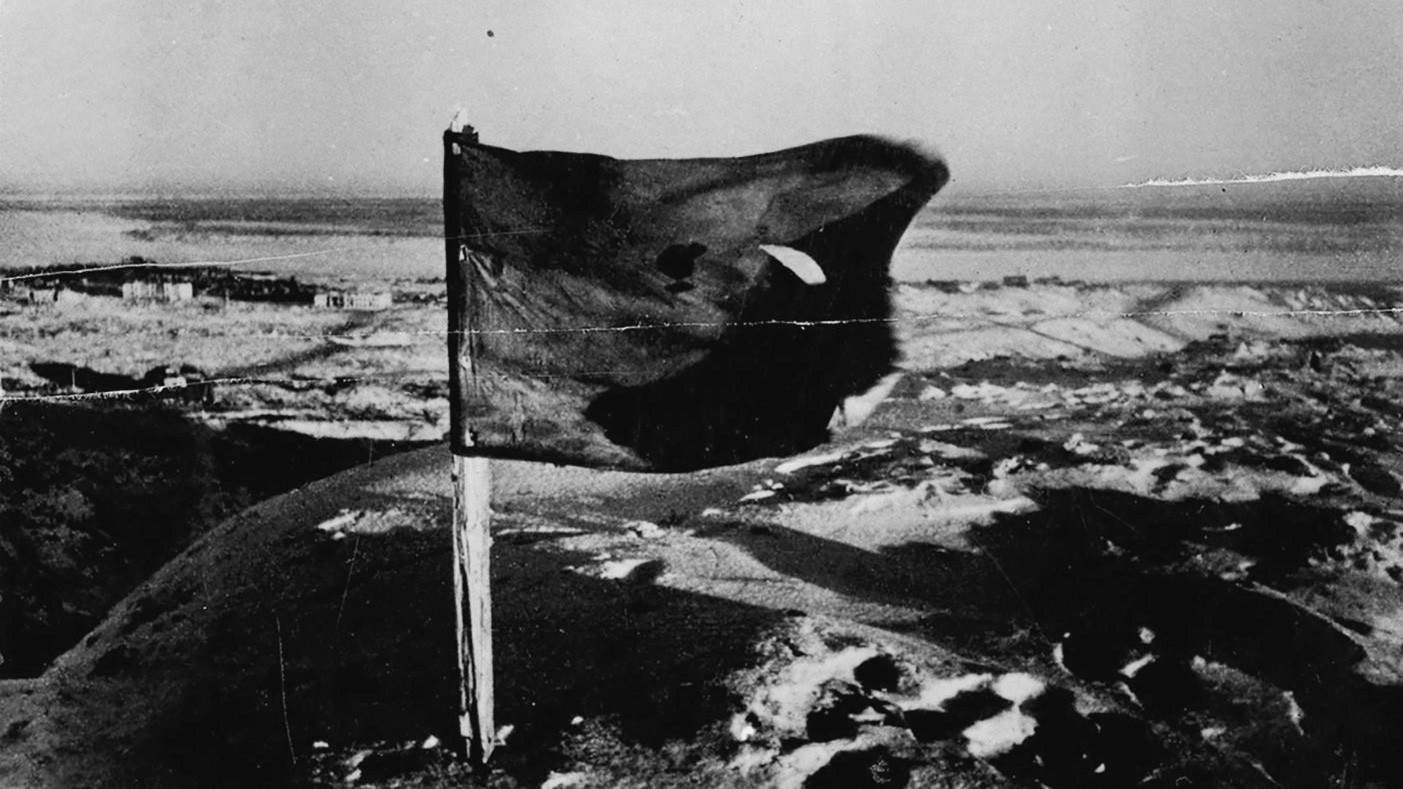
— In Stalingrad, they became important strategic heights, the battles for which could last months. The battles for Mamayev Kurgan began on September 14, 1942. Many times this peak changed hands, and the slope between the top of the kurgan and the railway track was plowed over by explosions of mines, shells, and bombs. Man-made landforms were also used during the battles. The area of the «Red October» factory was the scene of intense battles with the Nazis, where the fascists seized a slag mound on the northeast side of the plant. The Volga was no more than a hundred meters away. No less famous is Lysaya Gora (145.5 m high), located in the southern part of the city, a kind of analogue of Mamayev Kurgan in the southern part of Stalingrad.
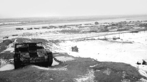
Stalingrad, Mamayev Kurgan, light French armored personnel carrier. Photo: https://waralbum.ru
The standard defense of the German army was built along the back slopes of the hills, which made it possible, on the one hand, to reduce the direct artillery impact of the Red Army troops, on the other hand, to hit tanks in the least protected parts, especially in the side and bottom. This is well described by General P. I. Batov during the storming of Cossack Kurgan.
— What have scientists discovered in the last 10–15 years?
Svetlana Argastseva: Nothing new has been discovered over the past 10–15 years, except for numerous traces of the war, mainly manifested in ravine systems, the largest of which are Dolgiy and Donniy Ravines, partially filled in after the Battle of Stalingrad (shell casings, fragments, and sometimes even unexploded bombs).
The depth of trenches, ditches, and dugouts rarely exceeded 2 m, but shelters with greater depth are found, especially in the sides of ravines, including those filled in after the war, as well as along the Volga. On the western slope of Mamayev Kurgan, during the construction of the «Marmelad» shopping complex at the beginning of the 21st century, a German concrete dugout was discovered, buried 7–8 m.
— In general, how do military actions change the landscape?
Yuri Knyazev: Changing landscapes during the fighting leads to the formation of so-called belligerent (from Latin. belligero «to wage war») complexes. In relation to Stalingrad, it looked something like this. In the area between the Yelshanka and Sukhaya Mechetka Rivers, the city was so destroyed that the ruins did not always reveal the direction of the former streets. The following figures also indicate the scale of the destruction: 9,000 wagons of debris and 20,000 wagons of twisted metal were removed from the site of the tractor plant alone.
During the rebuilding of the city, only a small part of the building debris was used. The main mass of them was fragmented, dumped into shallow ravines and gullies (including on the slopes of Mamayev Kurgan) or scattered and leveled off, forming a new surface 0.1–2 m higher than the previous indicators. V. A. Brylev noted that the average depth of destruction of the surface layer of the earth by explosions of mines, bombs, and large-caliber shells had reached 1.5–4 m. Below the epicenters of explosions, there was a significant compaction of rocks along the hemispherical surface of the bottom of the crater with a framing downwarping of the boundaries of the layers. This is still clearly visible in the walls of trenches and construction pits in the vicinity of Mamayev Kurgan. In the northern regions of the city (from Sovetsky to Traktorozavodsky), within the Khvalyn abrasion terrace (the coastal part of the city is located on it; here strong semi-rocky Paleogene silt sandstone lies close to the surface), the depth of the craters reaches 2–4 m. Unexploded land mines were stuck at the same depth.
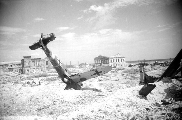
A downed enemy fighter jet in the center of Stalingrad. The Volga River is visible in the background. Summer of 1943. Photo: https://waralbum.ru
Svetlana Argastseva: Eyewitnesses testified that after the end of the Battle of Stalingrad and before the start of construction work, the kurgan had been a huge black hill. Not even grass grew on it in the warm season, and snow melted quickly in the cold. Sappers neutralized more than 40,000 shells, aerial bombs, and mines on it. The density of fire here was enormous: there were about 1,000 bullets and shrapnel per 1 square meter.
Aerial photographs of the city’s surroundings in some places clearly identify traces of urban defensive lines: trenches and anti-tank ditches.
— Are there analogues of Mamayev Kurgan anywhere else on the planet in this sense?
Yuri Knyazev: The equivalent of Mamayev Kurgan in world history is Fort Douaumont, a key link in the Battle of Verdun of January-December 1916, during the First World War. During the battle, the opposing sides (France and Germany) fired several million shells, including those with a caliber of more than 400 mm. This area is still uninhabitable due to the high levels of mercury, arsenic, and shell fragments.
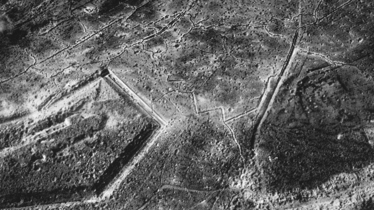
Location of the Battle of Verdun, top view. Trenches and shell craters are visible. Photo: https://en.wikipedia.org
— From time to time, materials appear in the media and social networks that Mamayev Kurgan was a special place in ancient times…
Svetlana Argastseva: Apparently, the authors of such materials are «inspired» by the place name itself. Objectively, there are simply no facts for such thoughts. No finds from the time of the Golden Horde have been discovered here. And if there was anything, it was destroyed during the Battle of Stalingrad and subsequent work during the construction of the monument «Heroes of the Battle of Stalingrad.»
— Some authors attribute esoteric meanings to Mamayev Kurgan. How characteristic is the reflection of real facts and social reflections in the new mythology of the place?
— Mamayev Kurgan is now the resting place of almost 50,000 soldiers and commanders of the Red Army. This is the main peak of Russia and the former Soviet Union. The sacred significance of Mamayev Kurgan is emphasized by the Church of All Saints on one of the former «brows» of the kurgan. We have no information about any special religious or mystical significance of the kurgan in antiquity and the Middle Ages. This is one of hundreds of similar hills scattered across the Volga Upland.
But the status of the place as the largest military necropolis in southern Russia and the place of death of thousands and thousands of soldiers leaves its mark on the «aura» of this area. This is what the priests who conduct divine services in the Church of All Saints and ordinary people say.
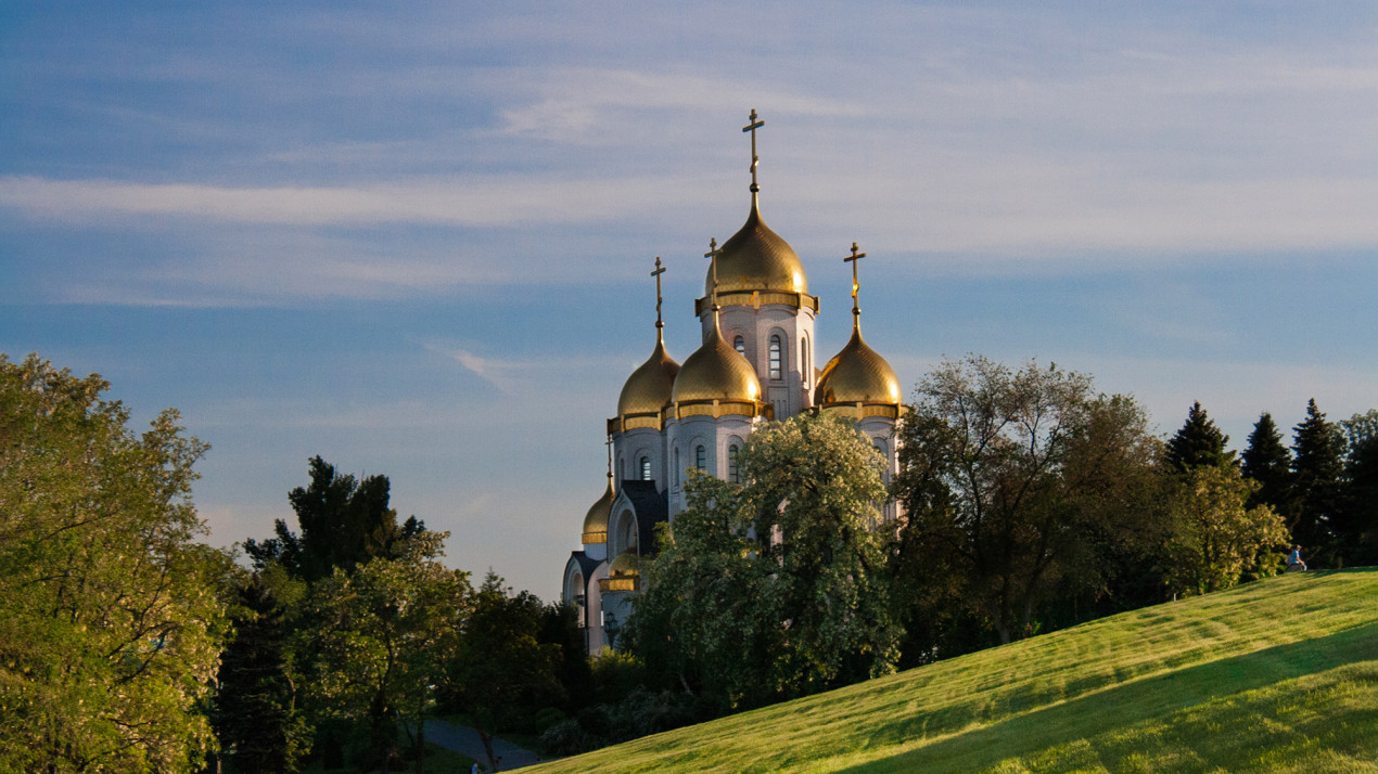
The Church of All Saints. Photo: Daria Sopeltseva, participant of the RGS's contest "The Most Beautiful Country"
— Can Mamayev Kurgan become a UNESCO World Heritage Site?
Yuri Knyazev: The complex «To the Heroes of the Battle of Stalingrad» on Mamayev Kurgan is certainly a memorial landscape of global importance. Unfortunately, no battlefield has yet been included in the UNESCO World Heritage List, as this type of heritage is perceived by the World Heritage Commission as including propaganda of violence, which is incompatible with UNESCO’s mission and the World Heritage values. Nevertheless, in 2013, the memorial complex was included in the preliminary list of UNESCO Heritage Sites from the Russian Federation. The most important argument is that battlefields should remind present and future generations of the horrors of war. They are a silent example of the struggle against violence, for pursuing politics only by peaceful means. By the way, there are precedents for the inclusion of locations similar in spirit. In particular, these are places of mass genocide of civilians (the Auschwitz concentration camp in Poland), places where nuclear weapons were first used (Hiroshima, Japan) or tested (Bikini Atoll, Marshall Islands).
Knyazev Yuri Petrovich is a Candidate of Geographical Sciences, Associate Professor at the Department of Geography, Geoecology, and Methods of Teaching Geography, Volgograd State Socio-Pedagogical University.
Argastseva Svetlana Anatolyevna is a PhD in Art History, Head of the Exhibition Department at the Battle of Stalingrad Museum-Reserve. Honored Worker of Culture of the Russian Federation.