The consequences of the natural disaster in Western Abkhazia in the summer of 2023 were assessed by the specialists from Lomonosov Moscow State University and their colleagues during a large-scale expedition of the Department of Geomorphology and Paleogeography of the Faculty of Geography. The field work, which allowed to collect a wealth of research material, was carried out from January 26 to February 6. Students and teachers, together with Abkhazian scientists, explored the territory of the Miuseri Upland and the Pitsunda Peninsula. The result of the expedition should be geomorphological maps and a plan for protecting the territory from dangerous phenomena of this kind. They will form the basis of the concept of safe environmental management.
The expedition was carried out as part of the ongoing long-term cooperation of geomorphologists from Moscow State University, scientists from the Institute of Ecology of the Academy of Sciences of Abkhazia, and the Faculty of Biology and Geography of Abkhaz State University.
“This is not the first time we have worked in Abkhazia together with our colleagues-geographers from the Institute of Ecology of the Academy of Sciences of Abkhazia. However, the last expedition was, by far, the most large-scale joint project for us. One of the main directions of the expedition's work was to study the consequences of the natural disaster that affected Western Abkhazia last summer. Two days of extreme rainfall caused enormous economic and social damage. Even the long-time residents of these places do not remember such an event. The study of the natural consequences of catastrophic rains and floods, the creation of geomorphological maps, and the assessment of potential hazards are the basis for ensuring safe environmental management in the future. These are the goals we set for ourselves when we went to study the consequences of the flood ‘while the trail was still fresh’," said Ekaterina Eremenko, head of the expedition, Associate Professor at the Department of Geomorphology and Paleogeography at the Faculty of Geography of Lomonosov Moscow State University, Candidate of Geographical Sciences.
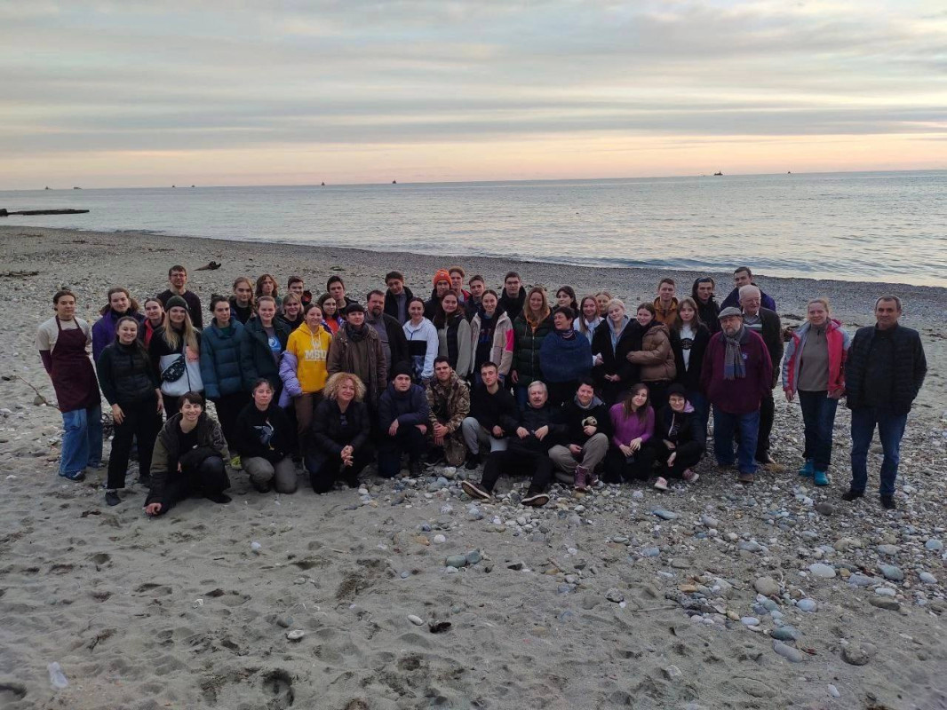
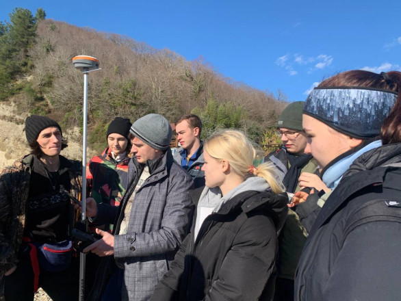
The participants of the expedition. Photo: Faculty of Geography of Lomonosov Moscow State University
During the work, flood zones were identified, the thickness of accumulated sediments was recorded, areas where landslides occurred and river banks were washed away were marked. The expedition participants conducted a survey of the local population, which allowed them to restore the chronology of the natural disaster, to identify its natural and social consequences. During the work, the territory was surveyed by unmanned aerial vehicles, geodetic works were carried out.
Within the framework of the scientific project, completely new research in other areas was also carried out for the territory of Abkhazia. In particular, for the first time in the last 30 years, a bathymetric survey of the seabed was done in the delta-front area of the Ryapsh River and the underwater Akula Canyon off the coast of the Pitsunda Peninsula. Geographers collected samples of bottom soils. The work will allow to estimate the volume of matter entering the coastal zone and the rate of its redistribution by coastal processes.
For the first time in Abkhazia, a station was equipped to monitor fluvial processes on the floodplain of the Ryapsh River in the area of the Miuseri Upland. The completed work will allow to further monitor the dynamics of erosion and accumulation in the floodplain, to assess the volume of displaced matter in a humid subtropical climate.

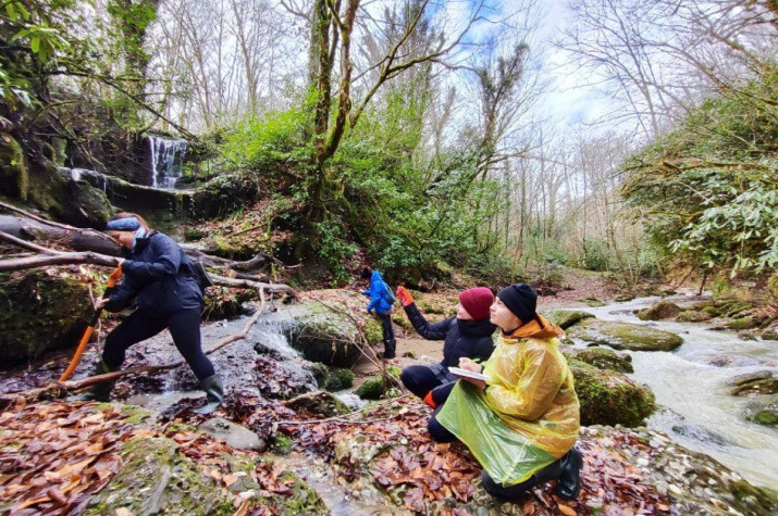
Members of the expedition during field work. Photo: Faculty of Geography of Lomonosov Moscow State University
The territory of the Miuseri Upland is an interesting area characterized by low geological and geomorphological study. The expedition participants described sections of conglomerates composing the upland, conducted a petrographic analysis of pebble samples to reconstruct the relationship between the uplift of the Greater Caucasus and the accumulation of molasse (rudaceous rocks) in the depressions surrounding it from the south.
During the exploration along the hill, the relief forms were described for the first time, which were formed due to the rare process of clastokarst: the subsidence of clastic rocks (clay, sandy, conglomerate) due to the dissolution of the inclusions of soluble components contained in them (gypsum, salt, carbonate). Paleogeographic studies have also been carried out. Thus, for the first time, a description of the section of the Late Pleistocene marine terrace in the Gudauta area. Manual drilling of the lagoon on the Pitsunda Peninsula with sampling for dating and analysis was performed.
Within the framework of cooperation between geographers and chemists from Moscow State University, for the first time in Abkhazia, a radiometric survey of an area of more than 100 square kilometers was carried out. Samples were also taken for the subsequent assessment of the deposition of technogenic radionuclides (in particular, caesium-137) for the last 80 years on the territory of Abkhazia. Direct measurements of the radon flux in the New Athos Cave and on the territory of the Pitsunda Peninsula were carried out.
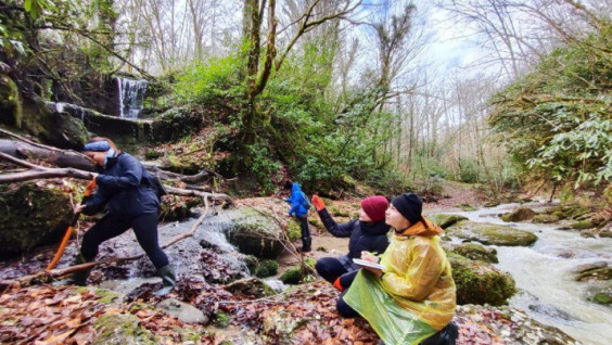
Members of the expedition during field work. Photo: Faculty of Geography of Lomonosov Moscow State University
The completed work was a continuation of fruitful cooperation between Russian and Abkhazian geographers in studying the natural environment of Abkhazia, its protection and assessment of the consequences of global climate change. The results of the expedition research have not only fundamental scientific, but also applied importance for the organization of effective measures to protect the territory from dangerous natural processes.
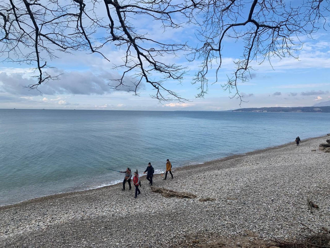
Members of the expedition during field work. Photo: Faculty of Geography of Lomonosov Moscow State University
“Within the framework of close scientific cooperation with Abkhaz State University and the Academy of Sciences of Abkhazia, our work was aimed, among other things, at mutual training of geographers and geomorphologists of the two friendly countries. It is gratifying that a large number of geography students took part in the expedition, who were able to improve their professional skills by solving relevant scientific and applied problems,” Ekaterina Eremenko emphasized.
More information about the results and participants of the expedition of the Department of Geomorphology and Paleogeography can be found in the article on the website of the Faculty of Geography of Moscow State University.
Alexander Zhirnov