
The «Wonders of Russia» festival of the Russian Geographical Society, which ended a week ago in Moscow’s Zaryadye Park, had become a platform for live stories about expeditions, Russian science, and travel. If you missed it, no worries, we will share the most interesting things from the world of field research and tourism.
90 Scientists, Three Weeks on a Desert Island, and One ATV
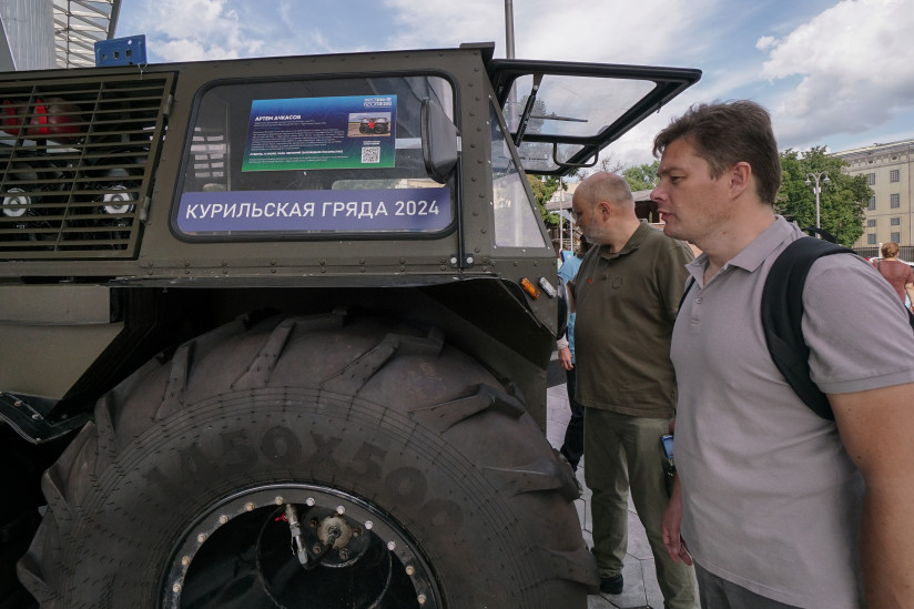
In 2024, the islands of the Great Kuril Ridge became a living scientific laboratory — 10 institutes launched their research there during the expedition «Eastern Bastion — the Kuril Ridge». In order to be able to do everything, the teams of scientists were divided into research areas. On Onekotan Island, work was underway on several fronts: geologists and geographers studied the terrain, and biologists explored the local flora and fauna. On Matua Island, the scientists found themselves in the past: they searched for traces of Japanese fortifications from World War II and examined underground passages. Artyom Achkasov, a witness to the events, a journalist and a member of the RGS, told about this at the lecture «90 Scientists, Three Weeks on a Desert Island, and One ATV». You can view it here.
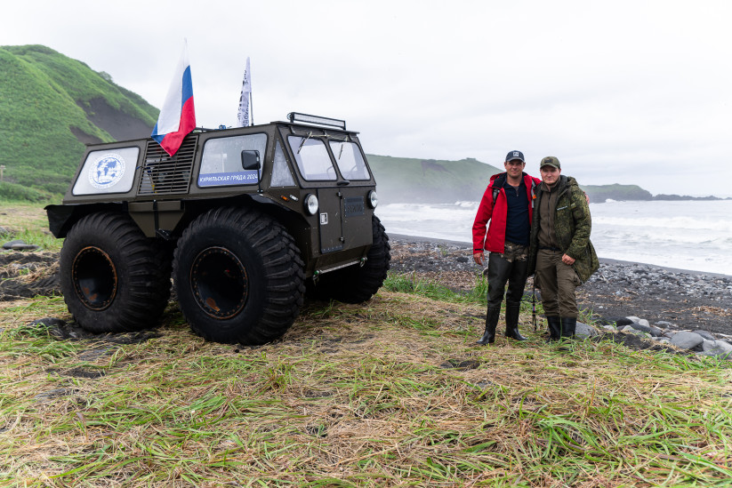
Swamp buggy in real field conditions, on Onekotan Island in 2024. Photo: Ksenia Mikhailova
Surviving the Earthquake
Simushir is one of the islands of the Kuril Ridge, which is part of the Sakhalin Region of Russia. It is known for its volcanic activity, as it is located in the Pacific Ring of Fire zone. Two tectonic plates collide there. Earthquakes on the island will not surprise anyone, the participants of the expedition «Eastern Bastion — the Kuril Ridge» often encounter this natural phenomenon. One of them was experienced by geophysicist Ekaterina Manuilova, a senior researcher at the Schmidt Institute of Physics of the Earth of the Russian Academy of Sciences. In her lecture «Geology and Picturesque Nature of Uninhabited Simushir,» she described the methods used by scientists to explore the Kuril volcanoes and how she survived a night earthquake. Explore the Kuril Islands with Ekaterina.
Expedition to Simushir in 2023. Photo: Ekaterina Manuilova's personal archive
Did you know that it is now possible to see the ships and vessels that have forever remained underwater as mute witnesses of battles from anywhere in the world? Thanks to the expeditions of the RGS, this became real, as Anastasia Fedosova, senior analyst of the data collection and processing group of the «Fertoing» company, told at the Festival. The Russian Geographical Society together with the Ludi Morya Foundation (eng. People of the Sea Foundation) have created the geographic information portal «Russia from Sea to Sea». The platform allows you to virtually visit thousands of unique sites: from polar stations in the Arctic to sunken ships in the Sea of Japan and ancient lighthouses in Chukotka. The portal’s collection includes about 9,000 detailed 3D models of cultural heritage monuments, hydrometeorological stations, and other locations. This is the only underwater digital museum in our country.
How can historical sites be preserved for future generations? Create a virtual copy of them. Daniil Bidenko, Senior Engineer and geodesist at «Fertoing», was doing this during the joint expedition of the RGS and the Ludi Morya Foundation. During his lecture, he explained how experts used aerial laser scanning to study the Japanese fortifications on the island of Matua. To do this, the specialists installed a LIDAR system on the quadcopter, which consists of a laser scanner, a camera, an inertial measuring unit, and a satellite receiver. It helps to capture every meter of the island with high accuracy.
Based on more than 42,000 photographs and the so-called point cloud (a collection of a large number of surface points in a three-dimensional coordinate system) with a total volume of 300 GB, experts have created a digital relief model, an orthophoto, and a three-dimensional model of the island.
The Spirits of the Karelian Land
In the mythology of the ancient Finns, the spirit of Ahti played an important role. He was revered as the supreme ruler of the water element. His power extended to lakes, rivers, streams, and waterfalls. Ahti’s favor was considered a prerequisite for safe sailing and bountiful fishing. According to tradition, this spirit was to be thanked and honored. Legends emphasize Ahti’s patronage of the people who settled along the banks of the Tokhmayoki River. The name of the river is of Finnish origin; it translates to «mad river». The Tokhmayoki is known for the Ruskeala Waterfalls cascade, whose streams create a dynamic landscape among the forest cliffs.
Kristina Demina, Head of PR and Communications at «ScanTour», spoke in detail about the ancient beliefs of the Karelians in a lecture. She noted that the Karelian landscape is the key to understanding the myths of local peoples.
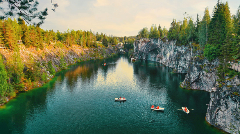
Landscapes of the marble canyon of Ruskeala Mountain Park in the Sortavala District of the Republic of Karelia. Photo: Evgeny Akimenko, participant of the photo contest "The Most Beautiful Country"
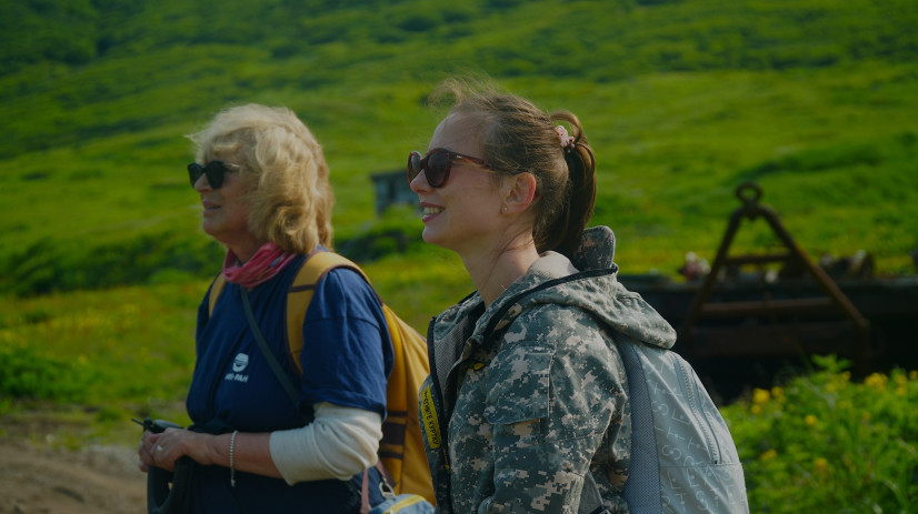
It is at the numerous lakes and rivers of the region that, according to legend, one can still feel the invisible presence of the spirit of Ahti. And the true perception of Karelian magic and its legends is manifested in moments of solitude in nature. This state allows you to fully immerse yourself in the atmosphere of these places: to feel the freshness of the pine air, listen to the tides of the river current, and mentally pay homage to the ancient guardians of Karelia, whose images have been shaping the spiritual connection of man with nature for centuries. It’s easy to travel to authentic and unexplored corners of Russia with the RGS, all active tours are available here.
Off-road Vehicles in the Center of Moscow
Equipment of this class attracts attention both on the islands of the Great Kuril Ridge and in Zaryadye Park, two minutes from Red Square. The unusual vehicles, which were presented at the RGS Festival, are used by researchers in real expedition conditions — from the remote islands of the Great Kuril Ridge to the Arctic deserts. For example, «Fenix» snow and swamp buggies were used by scientists during the exploration of the volcanic island of Onekotan in 2024. These amphibious all-terrain vehicles are highly maneuverable, capable of overcoming difficult terrain and obstacles typical of the island: marshy swamps, loose soil, ice fields, deep snow cover, sandy areas, and shallow rivers. On the Kuril Islands, the vehicle passed obstacles up to 90 cm tall, doing all this with passengers and special equipment.
A reliable member of the “Eastern Bastion – The Kuril Ridge” expedition. Photo: RGS press service
Another type of equipment used by the participants of the RGS expedition to explore Russia is the Russian all-terrain vehicle «Burlak». It is designed just for use in the extreme conditions of the Arctic, Siberia, and the Far East. The vehicle overcomes ice and snow and can transport people and goods in complete off-road conditions.
If you need to get from point to point quickly on an island, the best transport for researchers is the AODES all-terrain vehicle. The Workcross 1000–3 model can accommodate three people. And if you need to carry out geological exploration, then the best assistant for researchers is the PathcrossArmy ATV. It can transport equipment through difficult or narrow areas and tow trailers.


The Russian Geographical Society today offers tourist routes, expeditionary research, and a symbiosis of traditions with innovations: from the use of powerful all-terrain vehicles in the extreme conditions of the Kuril Islands to the creation of detailed 3D models of objects and digital museums.
Maria Buldakova